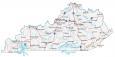
Map of Kentucky – Cities and Roads

About the map
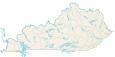
Our map of Kentucky shows cities, roads, rivers, and lakes. For example, Louisville, Lexington, and Frankfort are major cities shown in this map of Kentucky.
Kentucky is best known for baseball, bourbon, KFC, and horse racing derbies. “The Bluegrass State” is also home to Fort Knox, where the United States hides its gold.
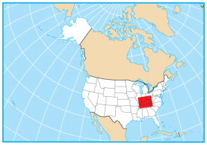
Kentucky is situated in the southeast of the United States with the Appalachian Mountains in the east. It borders Missouri, Illinois, Indiana, Ohio, West Virginia, Virginia, and Tennessee. Visit a bourbon distillery, explore caves, or tour one of the many museums. No matter what you choose to do, Kentucky is home to some of America’s most storied cities.
Kentucky map collection

You are free to use our map of Kentucky for educational and commercial uses. Attribution is required. How to attribute?
State capital
Frankfort
Major cities and towns
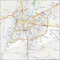
Louisville
Lexington
Frankfort
Bowling Green
Covington
Henderson
Hopkinsville
Owensboro
Paducah
Richmond
Pleasure Ridge
Park
Radcliff
Ashland
Bardstown
Corbin
Cynthiana
Danville
Elizabethtown
Fulton
Glasgow
Harlan
Harrodsburg
Hazard
London
Madisonville
Mayfield
Maysville
Mount Sterling
Mount Vernon
Paintsville
Pikeville
Princeton
Russellville
Florence
Paris
Jenkins
Somerset
Middlesboro
Marion
Leitchfield
La Grange
Independence
Morehead
Berea
Jackson
Scottsville
Campbellsville
Lebanon
Interstate highways
Interstate-24 (I-24)
Interstate-64 (I-64)
Interstate-65 (I-65)
Interstate-71 (I-71)
Interstate-75 (I-75)
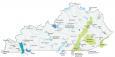
Lakes, rivers and creeks
Kentucky Lake
Lake Barkley
Dale Hollow Lake
Green River
Lake Cumberland
Licking River
Ohio River
Mississippi River
Tennessee River
Landmarks in Kentucky
Cumberland Plateau
Black Mountains
Where is Murray????
They are suppressing information, but they cannot escape the truth. We will find Murry, and bring it to the light.
Are any maps FREE?
Yes, it’s free.