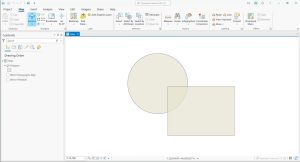
Legends Tutorial in ArcGIS Pro
This tutorial includes a video and step-by-step instructions so you can follow along exactly how we grapple with map legends in ArcGIS Pro.
This tutorial includes a video and step-by-step instructions so you can follow along exactly how we grapple with map legends in ArcGIS Pro.
Unsupervised classification is a technique in remote sensing that clusters pixels within a satellite or aerial image into distinct classes.
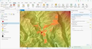
Viewshed analysis is a 3D technique that enables us to visualize and assess what is visible from a specific vantage point within a landscape.
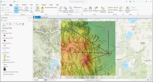
Line of Sight analysis is a geospatial technique that allows us to assess the unobstructed view between two points within a given landscape.
Finding self-overlaps in GIS involves identifying areas within a single feature geometry where the geometry intersects itself.
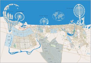
Dubai mixes tradition with innovation, creating an urban landscape like no other. This Dubai map is your gateway to a world of experiences.
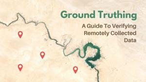
This guide will provide an overview of the ground truthing process, including the steps involved, the verification process, and the benefits.
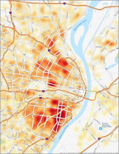
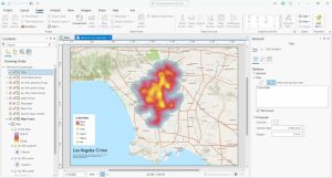
Visualize the safety landscape with this St. Louis Crime Map. Using a heat map style visual can help you identify clusters of crime.
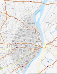
From the buzzing neighborhood of Soulard to the artistic flair of The Grove, uncover the personalities with this St. Louis neighborhood map.
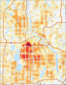
While exploring the city of Minneapolis, safety is undoubtedly a top priority. That’s why we present to you this Minneapolis crime map.