Ground Truthing: Verify Remotely Collected Data
Ground truthing assesses the accuracy of remote sensing data by comparing it with physical measurements collected at the ground level.
What is ground truthing?
Ground truthing is important because it can help confirm or refute the accuracy of the data. In order to ground truth data, researchers must visit the actual location and physically measure it at ground level.
Then, we compare this information with the data collected from remote sensing to determine its accuracy. Because a small error can lead to significant consequences, ground truthing is one of the first steps in the data collection process.
Benefits of ground truthing
As you’ve learned already, ground truthing assesses the accuracy of remote sensing data. Here are some of its benefits:
TRUSTWORTHINESS – Trustworthiness is another important benefit of ground truthing. If you’re using data collected remotely, you may have questions about the legitimacy of the data. Ground truthing can help you verify the data you’ve collected, which can add to its overall reliability.
CONFIDENCE – Confidence in the data you have collected is another benefit of ground truthing. If you have verified the data on the ground, you can be sure that it has a specific level of accuracy. This can give you a greater level of confidence in your data, which can be beneficial for your project.
CORRECTING ERRORS – Another way ground truthing can benefit your project is by helping you correct errors in your data. If you have verified the data on the ground, you can correct any errors in the data and use the correct version going forward.
Setting up a field survey
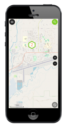
First, we start with a field survey to start the ground truthing process. During this step, you collect data on the ground. Then, this data can then be compared to satellite or aerial imagery.
A field survey can be conducted in many different ways, which can depend on the type of data you are collecting and the scale of your project.
Remember that the main purpose of a field survey is to collect data in the field and compare it to the data collected from the remote sensing imagery.
This comparison helps clear up any discrepancies or errors. Field surveys can also find problems with satellite imagery, like clouds or environmental factors.
Benefits of field surveys
Additionally, field surveys provide an opportunity to observe the area in question firsthand. This can help to gain a better understanding of the environment and its features.
Therefore, a field survey is essential for ground truthing, as it allows for the verified and reliable collection of data.
The alternative to an in-person field survey would be to use existing imagery sources. Aerial photography gives you a view from above, helping you compare remote and on-site data.
Although having boots on the ground is the gold standard, historical imagery can provide a different context for time. This would not be possible in a field survey.
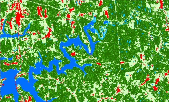
Verifying remotely collected data
For verifying land cover classification, we produce a land cover accuracy matrix to assess its accuracy. In general, we evaluate the reliability and accuracy of the data with two types of accuracy reports (1) producer accuracy and (2) user accuracy.
Producer Accuracy
Producer accuracy is a measure that determines how well the land cover predicts the true values of the data from the point of view of the map maker. It is typically calculated by dividing the number of correct classified sites by the total number of reference sites.
PRODUCER ACCURACY OF WATER = 28 correctly classified as water at reference sites / 30 total number of reference sites that are water
The total producer accuracy would be 93.3% for water. The higher the producer accuracy, the better the model is at predicting the true values of the data.
User Accuracy
On the other hand, user accuracy is a measure of how reliable a class is on the map compared to the ground from the user’s point of view. It is calculated by dividing the number of correctly classified instances by the total number of classified instances.
USER ACCURACY OF WATER = 28 correctly classified as water at reference sites / 35 total sites that are classified as water.
In this case, the user accuracy equates to 80.0% for the water class. The higher the user accuracy, the more reliable the model is at correctly classifying the data into its respective classes.
Overall, both are important metrics to measure the accuracy of data using field surveys and ground truthing. User accuracy and producer accuracy generally differ in their accuracy scores.
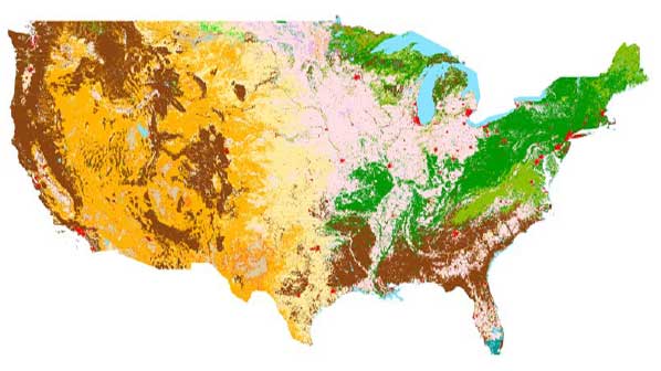
Real-world applications of ground truthing
We can apply ground truthing to a variety of industries, such as agriculture, forestry, and urban planning. However, it is especially useful in remote sensing. Here are some examples ground truthing:
AGRICULTURE – Farmers use data from satellites, like images or NDVI, to monitor their crops. By collecting ground truthing data, they can verify the accuracy of their data and check for any discrepancies.
LAND COVER – Ground truthing methods usually involve visiting sample sites and taking measurements or photos of the site. The field crew notes any discrepancies between the land cover map and what is observed on the ground. This process can identify errors in existing land cover maps to improve it over time.
FORESTRY – In forestry, ground truthing helps to assess the accuracy of a digital forest inventory collection. For instance, this may include the health and condition of a forested area. Ground truthing can also provide information on other factors. This includes the age and size of trees, the presence of invasive species, the extent of erosion, and the amount of vegetation cover.
Challenges of ground truthing
As beneficial as ground truthing can be, it can also come with certain challenges. First, you must ensure you have enough time to conduct a thorough and comprehensive field survey. Secondly, you also need to be sure you have the right equipment to conduct a successful survey.
TIMING – Timing is one major challenge associated with ground truthing. If you don’t go to the field within the correct timing window, you may not be able to verify all of your data.
EQUIPMENT – When doing ground truthing, it’s important to use the correct equipment for reliable and accurate results. This can include equipment such as GPS receivers, cameras, altimeters, and thermometers. Additionally, when measuring certain features, it is important to have the proper tools to get the most accurate readings. For example, when measuring tree heights and widths, field workers can use specialized tools such as clinometers or terrestrial LiDAR.
Summary of ground truthing
In this article, we’ve provided you with the benefits, real-world applications, and challenges of ground truthing. Additionally, we touched on how to set up a field survey and how you can use accuracy assessments.
But is there anything that we missed? We’d love to hear from you. What are some of the challenges that you experience in your field surveys? And how did you overcome them? Please let us know with a comment below.


Hello
I am searching for ground truth data for St John’s harbor Newfoundland for a school project. I will appreciate if you can reach out with this data if available. Thank you
Drone-collected imagery perhaps? Obviously some constrains there with cost and licensing but it is an option.
How can a professional carry out ground truthing if the location or site is physically inaccessible such as a swampy area or bad terrain?
This can be a very challenging thing to do for ground truthing. Over the decades, surveyors have fought through treacherous terrain so it’s nothing new. I’ve seen companies completely avoid areas for surveying because they put safety standards first (which is absolutely the right thing to do). I wish I had a good answer for you. But maybe, we’ll let some of the commenters join the discussion if they have some input.
I think, if they are working on landcover classification, and they wants to find out what landcover is that… his aim is already been achieved by identifying the true ground. Provided he can see the feature with his naked eyes, he should simply record what he has already seen.