Landsat 8 Bands and Band Combinations
We list Landsat 8 bands as well as popular band combinations which includes coastal, blue, green, red, NIR, SWIR-1, SWIR-2, cirrus and two thermal bands.

We list Landsat 8 bands as well as popular band combinations which includes coastal, blue, green, red, NIR, SWIR-1, SWIR-2, cirrus and two thermal bands.

The expression goes: “You can’t manage what you can’t measure”. And for measuring climate, it’s world climate data that benchmarks the health of our planet.
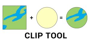
The clip tool cuts out an input layer to a defined feature boundary. Like a cookie-cutter, the output is a new clipped data output and subset.

Today, we’re going to show you the art of how to self-learn GIS. Even if GIS doesn’t run through your veins, you can inject these strategies.

From cartograms to contour maps, cartographers are like heroes. And every hero has a secret. If you want to build unbeatable maps, here are 25 map types.
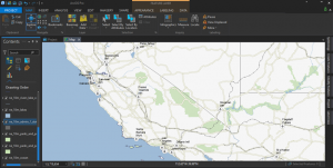
Are you thinking of switching to ArcGIS Pro? Whether it’s speed, slickness or simply raw power, here are 17 reasons to make the transition to ArcGIS Pro now

Spatial analysis solves location problems using math in maps. It blends geography with modern technology to better understand our world.
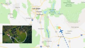
Full motion video ties your videos with maps. As you play a video, it doesn’t just show a moving point. It shows the whole video footprint on the map.
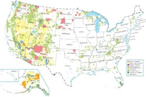
A United States federal lands map where the US government owns. It includes national parks, Indian Lands, national forest and fish/wildlife.

Indoor mapping specializes in mapping building floor plans. It can incorporate Revit, BIM, and CAD, and build floor plans from buildings.