The Gambia Map
A map of Gambia highlighting major cities, transportation and water – Gambia is in western Africa, bordering the Atlantic Ocean and Senegal.
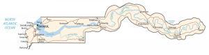
A map of Gambia highlighting major cities, transportation and water – Gambia is in western Africa, bordering the Atlantic Ocean and Senegal.
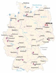
A map of Germany featuring cities, roads and water – Germany is located in central Europe, bordering the Netherlands, Poland and Denmark.
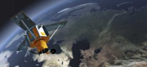
IKONOS provides panchromatic, natural-color, color-infrared and stereo images for cartographic, remote sensing and photogrammetric applications.
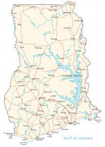
A Ghana map featuring major cities, roads and waterways. Ghana is in western Africa, bordering the Gulf of Guinea, Cote d’Ivoire and Togo
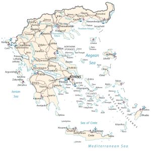
A Greece map with major cities, roads/highways and water features – Greece is in southern Europe, Ionian/Mediterranean Sea, Albania and Turkey
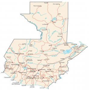
A Guatemala map highlighting cities, roads and water – Guatemala is located in Central America, bordering between El Salvador and Mexico.
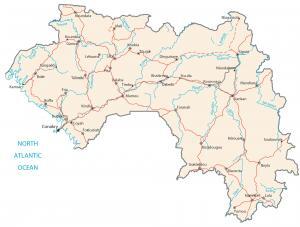
A Guinea map containing major cities, roads and hydrography – Guinea is situated in Western Africa between Guinea-Bissau and Sierra Leone.
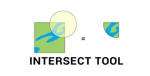
The Intersect Tool in GIS performs a geometric overlap. All features and attributes that overlap will become part of the output feature class.
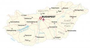
A Hungary map featuring major cities, transportation and hydrography – Hungary is located in central Europe, next to Romania and Slovakia.
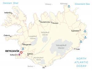
An Iceland map displaying cities, roads and water features – Iceland is an island located in Northern Europe, northwest of the United Kingdom.