What Is Geographically Weighted Regression (GWR)?
Spatial regression is used to model spatial relationships. Regression models investigate what variables explain their location.

Spatial regression is used to model spatial relationships. Regression models investigate what variables explain their location.
Unless you’re a data editing jedi, your GIS data may unknowingly have errors like gaps and overlaps. What to do? Fix errors using topology tools in ArcGIS
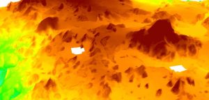
SAGA GIS has a quick and dirty tool to fill NoData holes with raster data. We show you how to close gaps in DEMs or any raster data with holes in it.
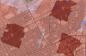
The ArcGIS Network Analyst Service Area analysis tool is perfect finding out just how far your cities firefighters, ambulance or paramedics can service.

ArcObjects is a library of Component Object Models (COM) to build UI components and stand-alone applications on top of the ArcGIS platform.

If your letters and words are all uppercase or lowercase in a field, and you want to capitalize the first letter of each word, use this Python code block.

So you want to geoprocess like a GIS guru, do you? From clipping to buffering, you will learn the basic GIS processing tools along with uses & applications
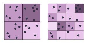
The modifiable areal unit problem (MAUP) is a statistical bias that occurs when you aggregate point data such as the scale and zonal effect.
Map algebra is a cell-by-cell combination of stacked raster grids. It uses math-like functions with arithmetic, statistics and trigonometry operators.
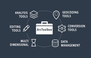
ArcToolbox is a collection of GIS tools for analyzing, editing and converting data. Each toolbox has a unique set of specialized tools for spatial analysis.