What is a Point Cloud?
A point cloud is a collection of points for storing data in LiDAR systems. Pulses of light represent the millions of points in a point cloud.
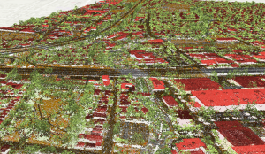
A point cloud is a collection of points for storing data in LiDAR systems. Pulses of light represent the millions of points in a point cloud.
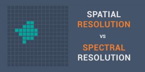
Spatial resolution is how detailed objects are in an image based on pixels. But spectral resolution is the amount of spectral detail in a band.
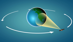
Synthetic Aperture Radar (SAR) is an emerging technology in remote sensing with the advantage to see in any weather condition and even at night.
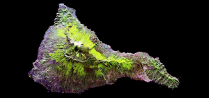
Hyperspectral imaging takes a spectrum of light and divides the light into hundreds of narrow spectral bands. For example, Hyperion has 242 bands at 30m GSD.
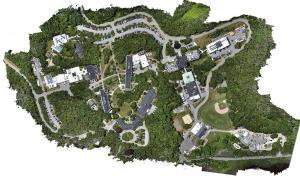
Photogrammetry uses photographs from at least two different vantage points. It obtains depth and perspective because of separate points of observation.
GOES and POES are both operational environmental satellites. But they actually share more in common such as their 40+ year legacy in space.
DigitalGlobe’s cutting-edge high resolution Worldview satellite carves out ridiculously crisp imagery at 31 cm in 8 spectral bands.

Geocaching is a treasure hunt style game using a GPS receiver. Geocaches are meaningful places that someone hand-picked to become a hiding spot.
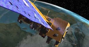
Despite popular belief MODIS is a satellite, it’s actually an instrument on-board a satellite. It has 36 bands, 250-1000 meter resolution and 2-day revisits.

A list of the 50 most iconic satellites put up into space to monitor our planet. We show the uses and types of satellites like weather and GPS satellites.