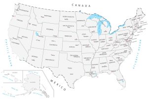
United States Map with Capitals
From Alabama to Wyoming, we display all 50 US states and capital cities. This United States map with capitals is a simple representation of continental US.
From Alabama to Wyoming, we display all 50 US states and capital cities. This United States map with capitals is a simple representation of continental US.
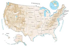
There are really several ways to see elevation in the United States. But the most common way to see a US elevation map is through a digital elevation model.
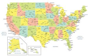
A USA map with states and cities that colorizes all 50 states in the United States of America. It includes selected major, minor and capital cities.
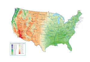
How much rain falls in the United States? Take a close look at this US precipitation map to see where it falls the most and least. You’ll see it fluctuates.
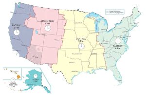
This US time zone map shows the six time zones of the United States such as the Eastern, Central, Mountain, Pacific, Alaska and Hawaii-Aleutian time zones.
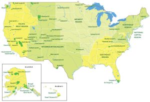
A US national parks map that displays the 5 regions and 62 national parks of the United States. Hawaii and Alaska have inset maps with outlines and names.
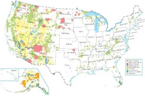
A United States federal lands map where the US government owns. It includes national parks, Indian Lands, national forest and fish/wildlife.
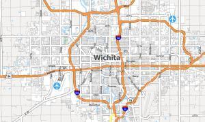
A Wichita map collection (highway/road map, things to do, and more!) for the city known for aircraft production, Pizza Hut, and White Castle.
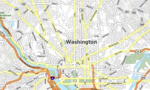
A Washington DC map (road map, things to do, and more!) of the federal district. It’s home of the president, the White House and Pentagon.
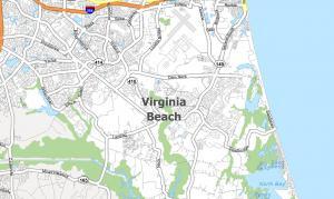
A Virginia Beach map (highway/road map, things to do list, and general map) for a resort city known for its boardwalks, beaches, and dining.