Mississippi County Map
This Mississippi county map displays its 82 counties. Hinds County, Harrison County and DeSoto County are counties that have the highest population
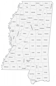
This Mississippi county map displays its 82 counties. Hinds County, Harrison County and DeSoto County are counties that have the highest population
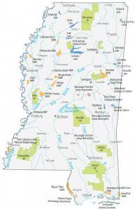
This Mississippi State Map shows major landmarks and places in Mississippi. It includes federal lands like national forests, military bases, and wildlife.
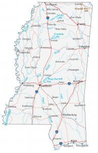
This Mississippi map contains cities, roads, rivers and lakes. Jackson, Biloxi and Southaven are some of the major cities shown in this map of Mississippi.
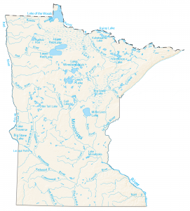
In this map, you will find major rivers and lakes of Minnesota. Lake of the Woods, Lake Superior and Red Lake are the largest lakes in Minnesota.
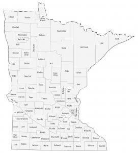
This Minnesota county map displays its 87 counties. Hennepin, Ramsey and Dakota are the most populated counties in Minnesota.
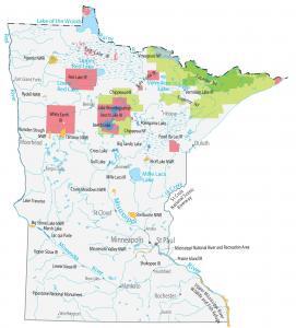
This Minnesota State Map shows major landmarks and places. It includes national forests, parks, wildlife refuges, major lakes and other federal lands.
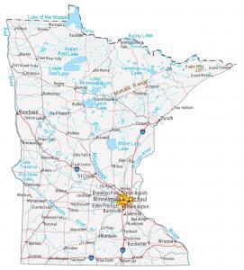
This Minnesota map contains cities, roads, rivers and lakes. St Paul, Minneapolis and Rochester are major cities shown in this map of Minnesota.
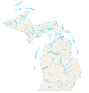
In this map, you will find major rivers, reservoirs, streams, bays and lakes in Michigan. More than 50% borders the Great Lakes.
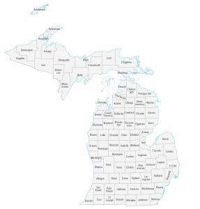
This Michigan county map displays its 83 counties. Wayne, Oakland and Macomb are some of the largest counties in Michigan in terms of population.
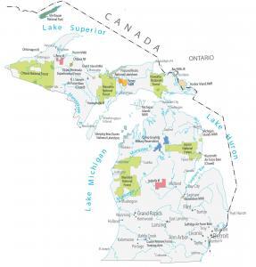
This Michigan State Map shows major landmarks and places in Michigan. It includes national forests, military bases, wildlife refuges and other federal lands.