Map of Canada – Cities and Roads
A Canada map highlighting major cities, roads and lakes/rivers – Canada borders the United States in the northern section of North America.
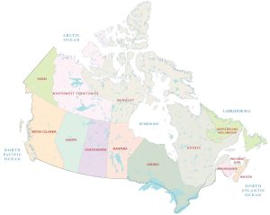
A Canada map highlighting major cities, roads and lakes/rivers – Canada borders the United States in the northern section of North America.
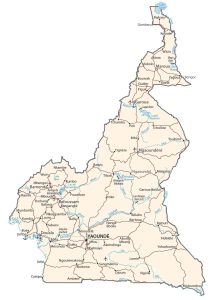
A Cameroon map featuring major cities, roads and hydrography – Cameroon is in central Africa, bordering Nigeria, Chad, Congo, and more.
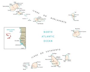
A Cape Verde map with cities, roads and islands – Cape Verde is a group of islands in the North Atlantic Ocean off west of Senegal, Africa.
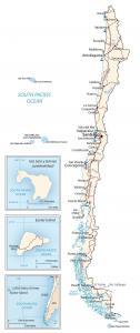
A Chile Map with major cities, roads and water – Chile occupies most of the west coast of South America, bordering Argentina, Bolivia and Peru
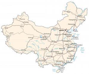
A China map highlighting major cities, transportation and hydrography – China borders Mongolia, Nepal, Burma, North Korea and the East China Sea.
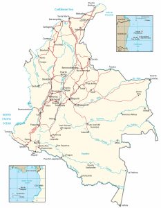
A map of Colombia with major cities, transportation and hydrography – Colombia is in northern South America next to Panama, Venezuela and Peru
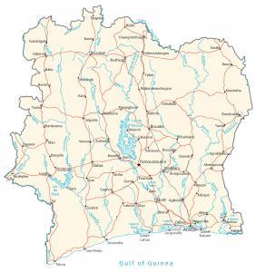
An Ivory Cost map featuring major cities, roads, and water – Ivory Cost is in West Africa bordering the Atlantic Ocean, Ghana, Mali, etc.
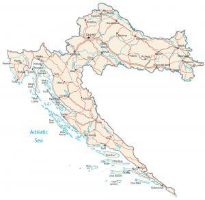
A Croatia map with major cities, roads and water – Croatia is in southeast Europe next to Adriatic Sea, Bosnia and Herzegovina and Slovenia.
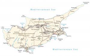
A Cyprus map showing major cities, roads and water – Cyprus is an island in the Middle East. It’s located in the Mediterranean Sea near Turkey
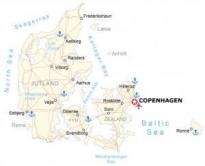
A map of Denmark containing cities, roads and water features – Denmark is in northern Europe, bordering the Baltic Sea and the North Sea.