Map of South Africa – Cities and Roads
A South Africa map displaying major cities, roads and water features – South Africa is at the southern tip of the continent of Africa.
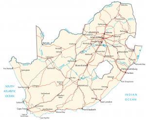
A South Africa map displaying major cities, roads and water features – South Africa is at the southern tip of the continent of Africa.
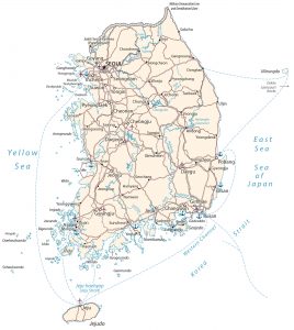
A map of South Korea with cities, roads and water – South Korea is in eastern Asia and occupies the southern half of the Korean Peninsula.
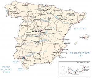
A map of spain featuring major cities, roads and water – Spain is in southwestern Europe, next to France and the the Mediterranean Sea.
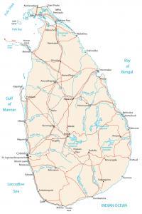
A Sri Lanka map featuring major cities, roads and water – Sri Lanka is an island located in southern Asia in the Indian Ocean, south of India.
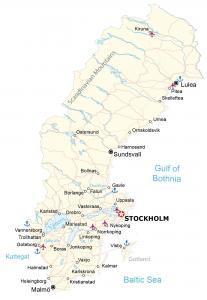
A map of Sweden containing major cities, roads and water features – Sweden is in Northern Europe, between Finland and Norway in Scandinavia.
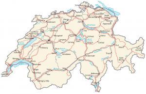
A map of Switzerland containing major cities, transportation and water – Switzerland is in central Europe, east of France and north of Italy.
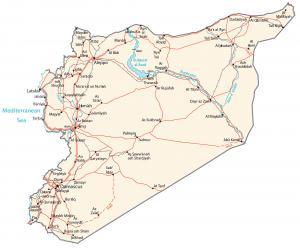
A Syria map featuring cities, transportation and water – Syria is in the Middle East, bordering the Mediterranean Sea, Lebanon and Turkey.
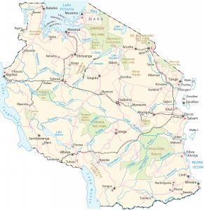
A Tanzania map with major cities, transportation and water – Tanazania is in eastern Africa, bordering the Indian Ocean, Kenya and Mozambique.
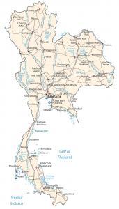
A Thailand map highlighting major cities, roads and water – Thailand is in southeastern Asia, bordering Burma, Laos, Cambodia and Malaysia.
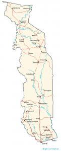
A Togo map featuring major cities, transportation and hydrography – Togo is in western Africa, bordering the Bight of Benin, Benin and Ghana.