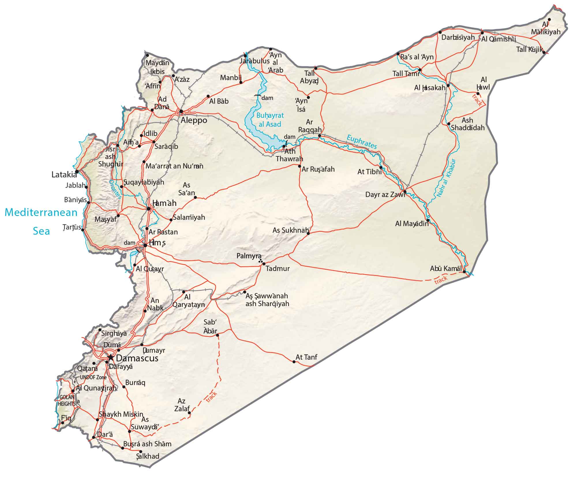
Syria Map – Cities and Roads
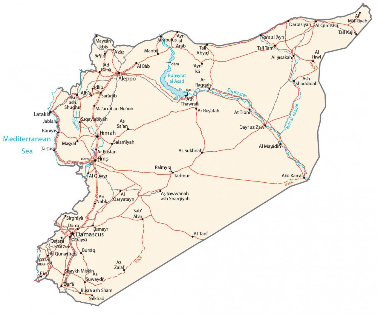
This map of Syria displays major cities, towns, rivers, lakes, and roads. Satellite imagery and a terrain map display everything from the Syrian Desert to the Euphrates River.
Syria map collection
You are free to use our Syria map for educational and commercial uses. Attribution is required. How to attribute?
About the map
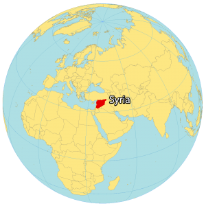
Syria is located in the Middle East, next to the Mediterranean Sea. It borders 5 countries including Turkey to the north, Iraq to the east, Jordan to the south, Lebanon to the west, and Israel to the southwest.
The country is known for its cultural history, conflicts, and civil war. It’s also one of the oldest civilizations. The capital of Syria is Damascus. But Aleppo is the most populous city.
Other major cities include Homs, Hama, and Latakia. Syria occupies an area of 185,180 square kilometers (71,500 sq mi). In comparison, it’s smaller than Kyrgyzstan but larger than Tunisia.
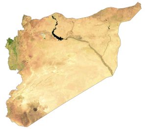
SATELLITE IMAGERY
Syria Satellite Map
Syria contains a mix of different types of landscapes like fertile plains, mountains, valleys, and deserts. Overall, Syria can be characterized as a hot, dry desert climate. During periods of high wind, it experiences dust and sandstorms, reducing visibility. Despite the dry climate, the country has rainy winters and even periodic snow in Damascus.
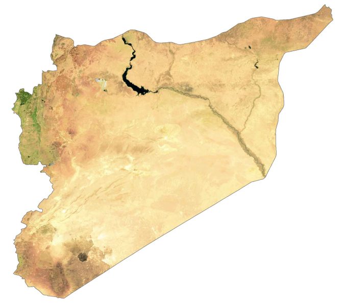
Its longest river is the Euphrates but drought conditions threaten the river with biblical reference. The largest lake in Syria is Lake Assad because of a dam constructed in 1973. Syria lies between 32°N to 37°N with an arid subtropical and Mediterranean coastal climate.
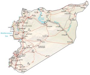
PHYSICAL MAP
Syria Physical Map
The terrain in Syria is a mix of coastal plains, deserts, and mountains in the west. Specifically, the Syrian Desert accounts for over 50% of the land area and is situated in the east. The Jabal al-Druze Range is a volcanic mountain in the south of Syria.
Another mountain range is the Anti-Lebanon mountain range, which straddles the border of Lebanon to the west. At 2,814 meters (9,232 ft), Mount Hermon is the highest peak in Syria along the Lebanon border as part of the Anti-Lebanon Mountains.
Capital City
Damascus
Major cities
Aleppo
Al-Hasakah
Dayr az Zawr
Raqqah
Hamah
Homs
Idlib
Latakia
Manbij
Palmyra
Ra’s al ‘Ayn
Tartus
Cities, towns and villages
Abu Kamal
Afrin
Al-Bab
Al-Malikiyah
Al Quayr
Al Qunaytirah
A’zaz
Baniyas
Dar’a
Darayya
Douma
Jablah
Jarabulus
Ma’arrat an Nu’man
Masyaf
Mayadin
Salamiyah
Saraqib
Tall Kujik
Tall Tamr
Tadmur
Lakes, rivers and seas
Euphrates River
Lake Assad
Mediterranean Sea
Nahr al Khabur
Orontes River