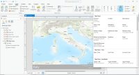
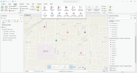
Data Driven Pages Mapbooks in ArcGIS

How to Use Data Driven Pages in ArcGIS
Data driven pages are a powerful map-making feature in ArcGIS 10. In ArcGIS Pro, this feature is map series.
Data driven pages allow you to export pages as a mapbook. For example, you can export all 50 US states into a PDF mapbook with the click of a button.
By creating mapbooks, you save time on map-making from hours to just minutes.
Sounds interesting? Let’s get started.
Step 1. Set Up Index Layer
The data driven toolbar is what you will need for generating mapbooks. You can access this toolbar by clicking: Customize> Toolbar> Data Driven Pages.
The “Data Driven Pages Setup” button (far left) is how to select the index layer. The index layer is the feature class that will control the pages of the mapbook. Each attribute record will represent a single page.
After enabling data driven pages, you can sort the pages in a mapbook. Setting your “sort” field defines what pages will be first and last in your mapbook.
Step 2. Define the Extent and Text in your Mapbook

There are three ways how the data driven pages tool handles map extents:
BEST FIT: In this map extent setting, it creates a margin around your features based on a percentage.
CURRENT MAP EXTENT: Each page centers on the features. But the scale will be the same throughout the mapbook.
SCALE FIELD: Based on a scale field in your attribute table, your pages zoom in and out accordingly.
The other options on the toolbar are to refresh and move forward and back in your mapbook. When you click the arrow key left and right, this is how you move backward and forwards in your mapbook.
The last option on the right (Page Text) allows users to include dynamic text on each page. For example, you can include a page number, name, or attribute. You can display dynamic text by clicking: (Insert> Dynamic Text).
Step 3. Export Mapbook

To export a data driven pages mapbook, click File > Export Map…
Select type as PDF. Under the “Pages” tab, to compile all choose the “All” radio select button.
Common errors:
- If you forget to select “all”, it will only export a single page in the PDF.
- You cannot export JPG, PNG, or TIF as mapbooks because only PDFs allow multiple pages.
Data Driven Pages
The data driven pages tool saves time, automates workflow, and reduces the chance of human error.
Map automation is about turning your GIS software into a paper map pumping machine.
First, build a strip map for each extent in your mapbook. Then, pump out maps with the right rotation and scale.
In ArcGIS Pro, this tool is rebranded as a “Map Series”. Whereas QGIS 3 calls it the Atlas.


If I have a district shapefile for a state and I need to create district map, is there any way that I can clip to each district and display the data?
Is there a way I can make a map book using a a raster layer as my index layer?In my case, it is my slope (percent rise) layer. Perhaps there is a workaround? I’m working in ArcGIS 10.5.1
Not that I know of. You would have to combine slope (by percent rise) into groups. From there, you can go from raster to vector