Egypt Map – Cities and Roads
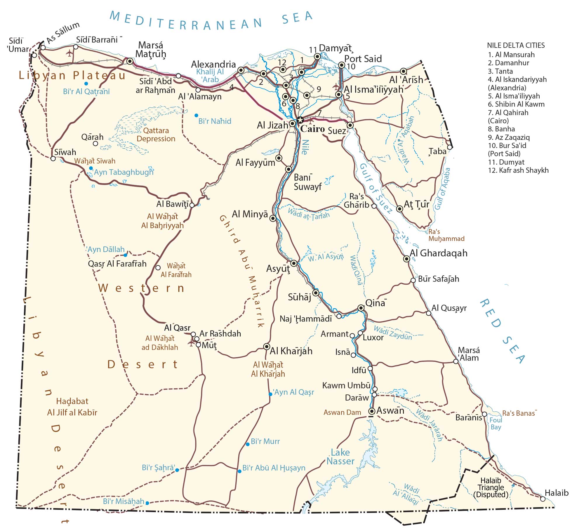
This map of Egypt contains major cities, roads, rivers, and lakes. It features an elevation map and satellite imagery showing the topography of the Nile River and its vast number of deserts.
Egypt map collection


You are free to use our Egypt map for educational and commercial uses. Attribution is required. How to attribute?
About the map
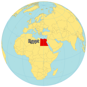
Egypt is a country located in northeastern Africa along the Mediterranean and the Red Sea. It borders Libya to the west, Sudan to the south, as well as Israel and the Gaza Strip (Palestine) to the east. Cairo is the capital and largest city of Egypt with the largest metropolitan area in the Middle East.
Egypt has a rich history as one of the world’s earliest and greatest civilizations. For example, the Great Pyramids of Giza and the Great Sphinx are absolute marvels and world-renowned monuments. Also, Egyptians first used hieroglyphics and pioneered developments in agriculture and human settlements.
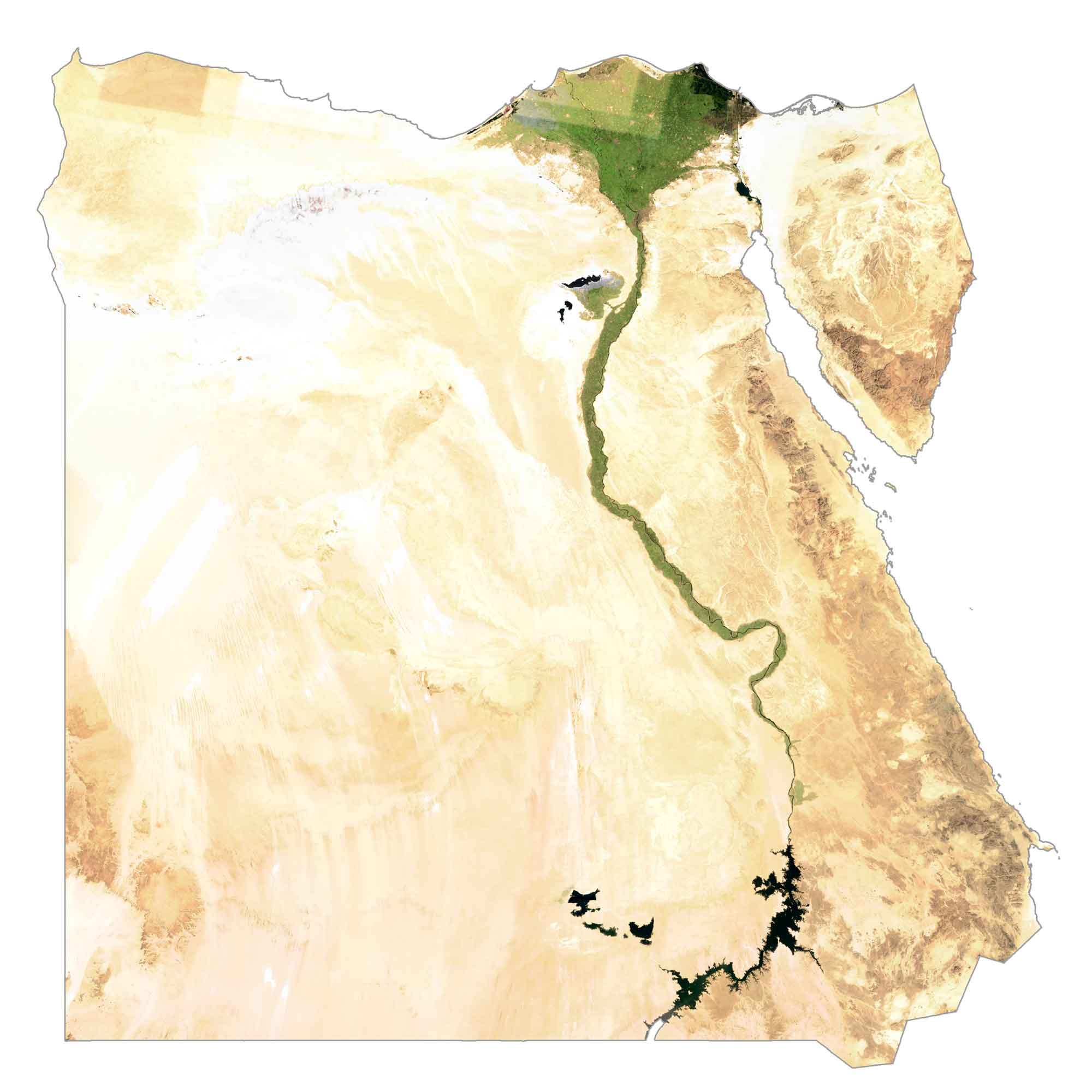
SATELLITE IMAGERY
Egypt Satellite Map
Egypt occupies an area of 1,010,408 square kilometers (390,121 sq mi), which is the 12th largest in Africa. This makes the country’s total area slightly smaller than Mauritania and larger than Tanzania.
The longest river in the world, the Nile River, flows northward through Egypt for about 750 miles (1,200 km). When it terminates at the Mediterranean Sea, it spreads out and forms the triangular-shaped Nile Delta. This area is home to 40% of its population (around 95 million people) and its fertile land is completely covered with farming and agriculture.
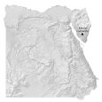
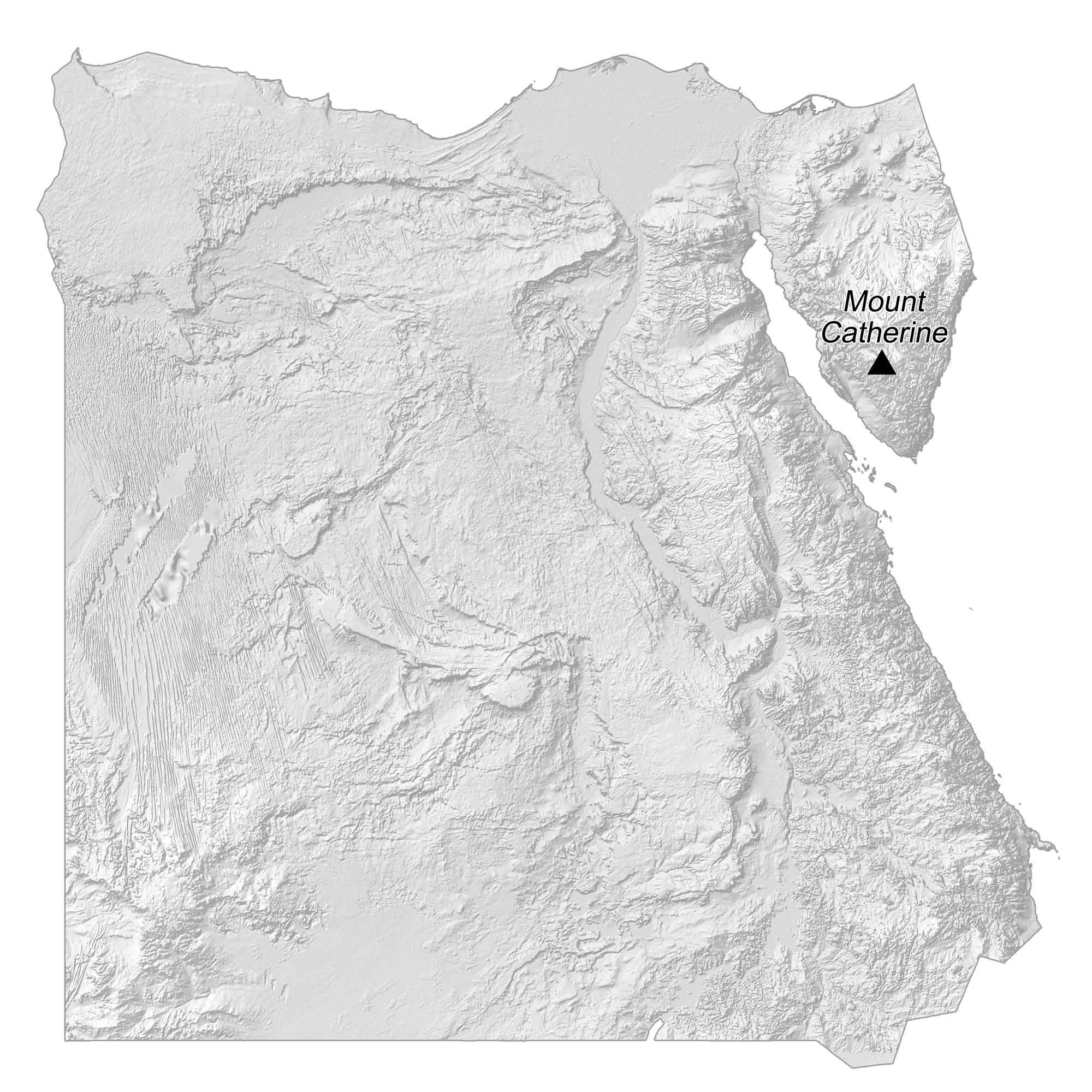
PHYSICAL MAP
Egypt Elevation Map
Egypt is characterized by its vast swaths of deserts throughout the country like the Great Sand Sea and the largest hot desert in the world, the Sahara Desert. But the country also has several low-lying mountains and of course the Nile River and Delta.
In the southern region, the landscape contains low mountains from the Gilf Kebir Plateau. Further east, the terrain becomes more mountainous. Whereas Northern Egypt has wide valleys near the Nile and desert to the east and west. At 2,629 m (8,625 ft) in height, Mount Catherine is Egypt’s highest peak.
Capital City
Cairo
Major cities
Alexandria
Al Jizah
Al Mansurah
Asyut
Bur Sa’id (Port Said)
Luxor
Shubra El-Kheima
Suez
Tanta
Cities and towns
Al Arish
Al Bawiţi
Al Fayyum
Al Ghardaqah
Al Isma’iliyyah
Al Ismailiyyah
Al Kharjah
Al Minya
Al Qasr
Armanto
Ar Rashdah
As Sallum
Az Zaqaziq
Bani Suwayf
Baranis
Banha
Bur Safajah
Damanhur
Damyat
Daraw
Dumyat
Idfu
Isnã
Kafr ash Shaykh
Kawm Umbu
Marsá Matrūḥ
Müt
Naj ‘Hammādī
Qarah
Qasr Al Farafrah
Qina
Ra’s Gharib
Shibin Al Kawm
Siwah
Sidi ‘Umar
Sidi Abd ar Rahman
Sidi Barrañi
Suhaj
Tabā
Lakes, rivers and creeks
Ayn Dällah
Ayn Tabaghbugh
Bi’r Abū Al Husayn
Bi’r Al Qatrani
Bi’r Murr
Bi’r Nahid
Bi’r Şahra
Bi’r Misäḥah
Foul Bay
Gulf of Aqaba
Gulf of Suez
Khalij Al ‘Arab
Lake Nasser
Mediterranean Sea
Nile River
Red Sea
Wadi at-Tarfah
Wadi Jararah
Wadi Qina
Wadi Zaydūn
Wādī Al ‘Allaqi
Geographic features
Al Alamayn
Al Wahat
Libyan Plateau
Qattara Depression
Ra’s Muhammad
Ra’s Banas
Wahat Siwah
Wahat Al Farafrah
Western Desert
Disputed territories
Hala’ib Triangle
Bir Tawil (Unclaimed Land)
Northern Africa


Changelog
July 27, 2024 – Added Hala’ib Triangle as a disputed territory (southeast of section of Egypt)
Halayeb and Shalateen are Egyptian lands located under Egyptian administration and are not part of Sudan. Please amend the site maps.
Yes. I added in the Hala’ib Triangle as a disputed territory. Both countries lay claim to the land so it makes sense to include it. You can see this now in the southeast part of the map.