Geodesign: Integrating Geography and Design
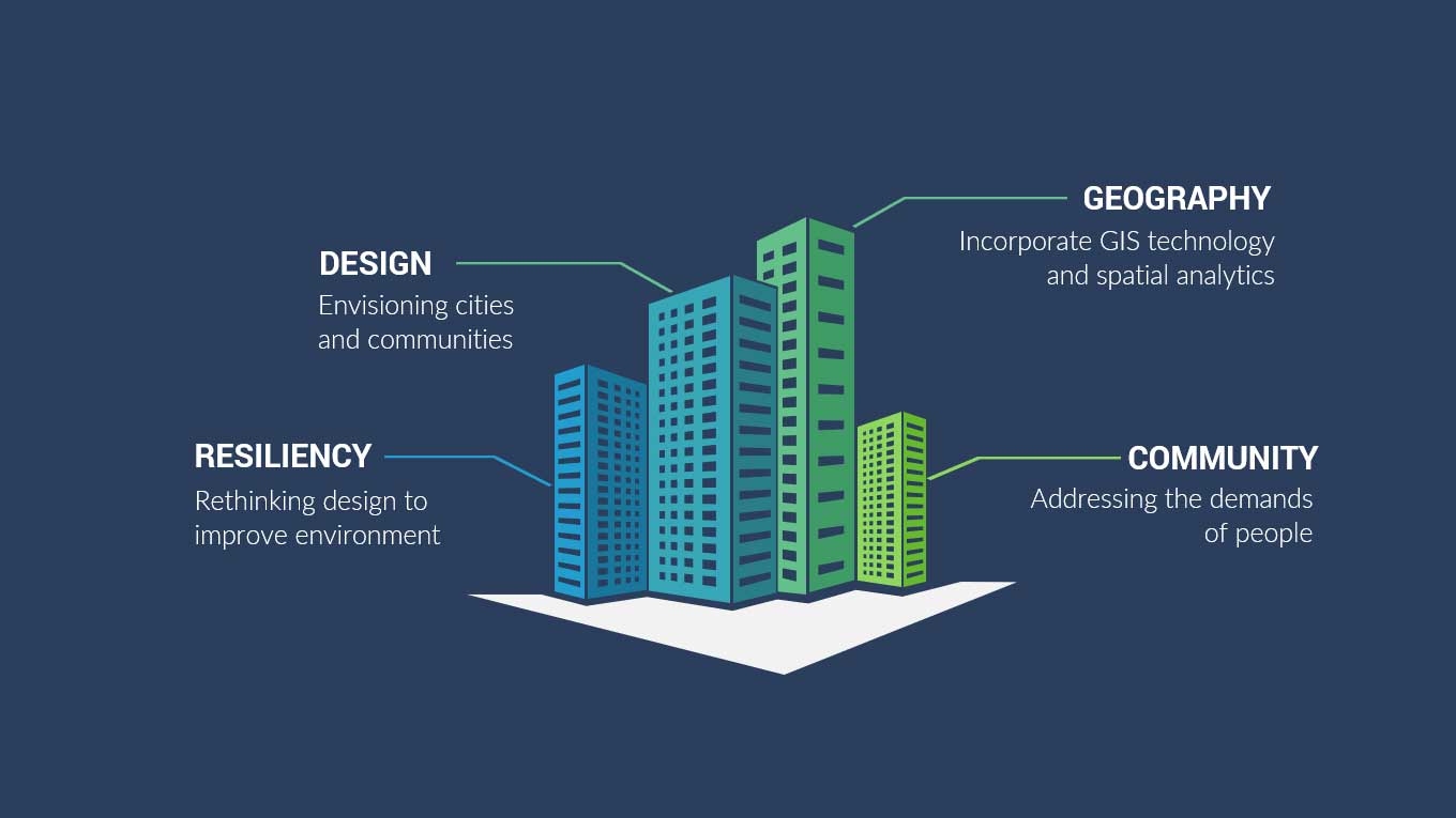
Integrating Geography and Design for Sustainable Solutions
Geodesign is an up-and-coming field of study that combines geography with design (hence the term “Geodesign”.
The design process is what shapes our world by addressing the needs of people. It’s imaginative and envisions what the world could be.
But the flaw with just practicing design is that it doesn’t consider the consequences of actions.
And it was not until recently, that these two disciplines have been completely separated from each other.
Similarities and differences between GIS and design
Both design and GIS have a spatial aspect to them. For example, design rethinks how we inhabit the world. Simply, it makes things work in geographic space.
Similarly, GIS emphasizes geographic location. But the key difference is its power in analysis, visualization, and data analytics.
Both design and GIS have temporal aspects intrinsic to them. For instance, design constructs a place that is ideal for future purposes.
But GIS best understands the past and present. It takes existing data and uncovers spatial patterns. Then, decision-makers use these patterns to solve a particular issue.
Geodesign for an extinction-proof environment
The “design” imagines what the world could be. It accomplishes this by addressing the immediate needs of people. But by putting people’s needs as a top priority, it doesn’t look at the consequences of actions.
So geodesign imagines cities by incorporating the environment, distant populations, and future generations. Instead of considering what’s best, it considers what’s best down the road.
For example, we fragment the forest and pollute the air and oceans which impact ecosystems. But at the end of the century, scientists project that half of all species will face extinction.
Geodesign makes design decisions with renewable energy and zero-carbon without disrupting the food and water supply. So when design can incorporate GIS, it can enrich architectural design that is diverse to withstand shifts in climate.
Rethinking design for more resilient communities
The world population is the biggest stress. As we approach 8 billion people on the planet, geodesign enables us to see the local and global consequences of design decisions.
It helps us rethink how we inhabit the planet and use our finite resources more consciously. For example, real-time data can enrich our abilities to make decisions.
GIS is best at understanding spatial patterns and constructing qualitative solutions. This holistic approach to geodesign can help us prolong our ability to sustain ourselves and build resilient communities.


This is a very essential tool
This is good insight. Not only urban plans, all developmental plans should work in holistic with past and present geographic information to ensure sustainable environment and create resilient community against different future natural and man made hazards.