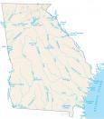
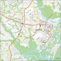
Georgia Lakes and Rivers Map
About the map
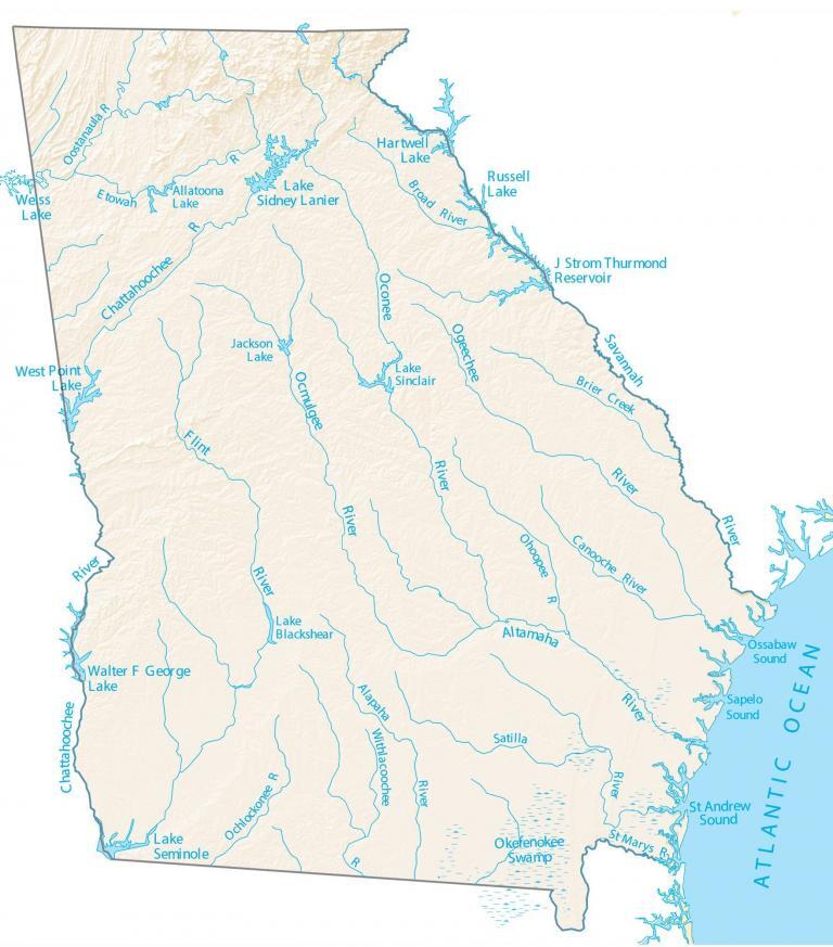
In this map, you will find major rivers, reservoirs, and lakes of Georgia like the Altamaha and Ogeechee. Its location along the Atlantic Ocean and its lakes are great for boating and leisure activities.
The largest lake in Georgia is the J. Strom Thurmond Lake which is on the edge of the South Carolina border. Next, Hartwell Lake is the second largest extending to six counties in two states.
In western Georgia, it’s the Chattahoochee River that forms its boundary line with Alabama. Then on the eastern side of Georgia, the Savannah River creates its boundary line with South Carolina. Also, St. Mary’s River forms the southeastern boundary with the state of Florida.
Georgia map collection
You are free to use our lakes and rivers map of Georgia for educational and commercial uses. Attribution is required. How to attribute?
Georgia lakes, rivers and reservoirs
Lakes and reservoirs
Hartwell Lake
Lake Sidney Lanier
Walter F George Lake
Weiss Lake
Russell Lake
J Strom Thurmond Reservoir
West Point Lake
Lake Sinclair
Lake Blackshear
Allatoona Lake
Lake Seminole
Jackson Lake
Rivers and streams
Altamaha River
Ogeechee River
Oconee River
Flint River
Savannah River
Chattahoochee River
Ocmulgee River
Satilla River
Ochlockonee River
Alapaha River
Chattahoochee River
Etowah River
Oostanaula River
Broad River
Ohoopee River
Canooche River
St Marys River
Withlacoochee River
Swamps, inlets and sounds
Brier Creek
Okefenokee Swamp
Ossabaw Sound
Sapelo Sound
St Andrew Sound
Your map is pathetic. Many prominent lakes and rivers are MISSING.