Natural Earth Data – Free GIS Public Domain Data
Natural Earth is a public domain GIS data package that has all the essential layers you need to create a map. For example, it has administrative, hydrographic, and general land information.
In fact, Natural Earth data is so good that we have it as the #1 data source in our top 10 free GIS data sources.
Natural Earth provides you with quick-start kits so they make the perfect base map in any GIS software you use. Map scales are at 1:10m, 1:50m, and 1:110m.
The best part? It’s built by volunteers from around the world and is supported by the North American Cartographic Information Society (NACIS).
Download Natural Earth GIS Data

Because time is valuable for all of us, Natural Earth gives a quick start map layout file as an ArcMap MXD and QGIS QGS file.
With a double click of any of these map layouts, you get all the necessary files for a visually pleasing cartographic map.
But keep in mind that the quick start maps don’t come with all the data available. You can sift through all the freely available data to really add more value to your map.
Public Domain GIS Data
The best thing of all is that Natural Earth data is all in the public domain. According to its terms and conditions, the authors give permission to modify, disseminate and use the data in any manner.
With that said, users are always welcome to cite the source of the data. This public domain map data was created by a group of volunteers and is supported by NACIS.
What data is part of Natural Earth?
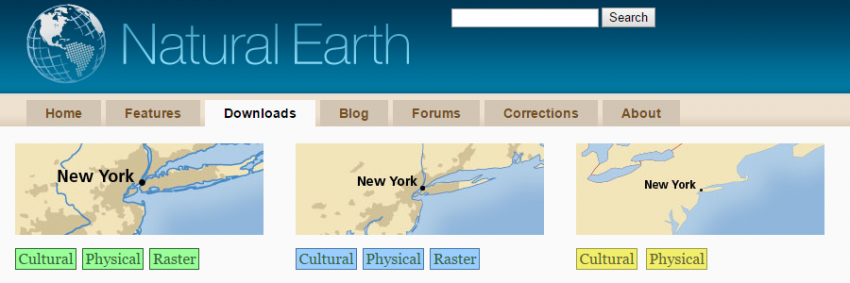
1. Cultural Vector Data
You will find a range of vector data specifically for different map scales.
For example, it includes the following cultural features:
- Administrative boundary lines (countries, states, provinces, populated places, urban areas, and disputed areas)
- Transportation (airports, roads, railways, and sea ports)
- Geographic lines and graticules
2. Physical Vector Data
For physical features, it contains a mix of hydrography, terrain, and ocean features. For example, it includes the following:
- Hydrography (Oceans, rivers, and lakes)
- Terrain (Mountain peaks, major and minor islands)
- Ocean (Coastlines, coral reefs, and ocean bathymetry)
3. Raster Data
The raster datasets consist of low-resolution grids on a global scale. These are perfect for continental or global scale base maps.
- Cross-blended hypsometric tints
- Ocean bottom bathymetry
- Shaded relief and gray Earth
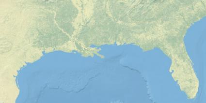
The Perfect Base Map: Natural Earth Data
Here are more reasons why you need Natural Earth in your repertoire.
- It contains most major map features (cultural, physical, and raster data)
- The data is public domain
- Its layers are aesthetically pleasing in vector and data format
Give these free public domain GIS datasets a try. It just may be the GIS base map data you were looking for all along.


It seems that naturalearthdata.com is having technical difficulties with redirects. Because of this, downloading data is impossible at the moment. Is there someone I can contact to get this problem fixed?
Or…. is there another way to get ne_10m_populated_places.zip?
Seems to be working well for me. Give it another try.
How I download free data sets of urban land remote images .
Your two best options are:
1. OSM Data – https://gisgeography.com/openstreetmap-download-osm-data/
2. Land Cover – https://gisgeography.com/free-global-land-cover-land-use-data/
Hello how are you are doing? I have downloaded the cultural and physical zip files for natural earth but the files are missing shape files (shp) for loading in QGIS 2.18 rather its containing the shp files for AutoCad. What should i do to obtain the shp files for QGIS?
Thank you
The SHP files will work for QGIS 2. Just drag and drop them in your canvas, and you’re good to go.
Hi.. Can we get underground imaging using satellite data like burials, gold etc.