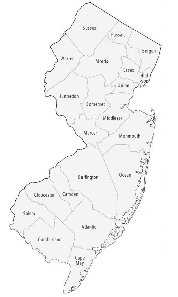
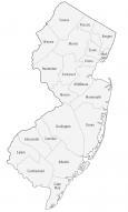
New Jersey County Map
About the map
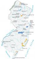
This New Jersey county map displays its 21 counties. New Jersey borders New York, Pennsylvania, and Delaware and is very close to Connecticut in the north and Maryland in the south. But they don’t actually border each other.
Bergen County is the most populated county in New Jersey, which has close to 1 million people. Then, this is followed by Middlesex, Essex, and Hudson. Whereas the county with the lowest population in New Jersey is Salem County.
For size, Burlington County is the largest, occupying an area of 819.1 square miles. Next is Ocean County, which contains Long Beach Island along Barnegat Bay. Hudson County is the smallest county in New Jersey and is less than 50 square miles in area.
You are free to use our county map of New Jersey for educational and commercial uses. Attribution is required. How to attribute?
New Jersey County List
| FIPS Code | Name | Land (sq mi) | Water (sq mi) | Population (2024) |
|---|---|---|---|---|
| 34-001 | Atlantic County | 555.5 | 116.3 | 279,114 |
| 34-003 | Bergen County | 232.8 | 13.7 | 978,641 |
| 34-005 | Burlington County | 799.3 | 20.9 | 475,515 |
| 34-007 | Camden County | 221.3 | 6.1 | 533,988 |
| 34-009 | Cape May County | 251.5 | 368.8 | 93,875 |
| 34-011 | Cumberland County | 483.4 | 194.5 | 155,678 |
| 34-013 | Essex County | 126.1 | 3.3 | 881,527 |
| 34-015 | Gloucester County | 322.0 | 14.8 | 311,783 |
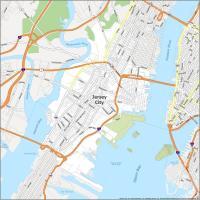
| 34-017 | Hudson County | 46.2 | 16.2 | 736,185 |
| 34-019 | Hunterdon County | 427.8 | 9.6 | 131,708 |
| 34-021 | Mercer County | 224.4 | 4.4 | 392,138 |
| 34-023 | Middlesex County | 309.2 | 13.7 | 890,119 |
| 34-025 | Monmouth County | 468.2 | 197.3 | 647,520 |
| 34-027 | Morris County | 460.6 | 21.0 | 523,053 |
| 34-029 | Ocean County | 628.4 | 286.5 | 666,434 |
| 34-031 | Passaic County | 186.0 | 12.4 | 526,597 |
| 34-033 | Salem County | 331.8 | 40.7 | 65,874 |
| 34-035 | Somerset County | 301.9 | 3.1 | 357,467 |
| 34-037 | Sussex County | 518.7 | 16.7 | 147,444 |
| 34-039 | Union County | 102.8 | 2.7 | 594,160 |
| 34-041 | Warren County | 356.5 | 6.1 | 112,031 |