QGIS OpenStreetMap: OSM Plugins for QGIS
QGIS OpenStreetMap: OSM Plugins for QGIS
Do you want to use OpenStreetMap for QGIS? Or do you want to access the raw data for you to download?
If you answered yes to any of these questions, then you should take a look at the QGIS OpenStreetMap plugins for QGIS.
This tutorial will walk you through how to add layers from OpenStreetMap using QGIS.
Plus, it will show you how to download OpenStreetMap data so you can use the raw points, lines, and polygons.
What is OpenStreetMap?

OpenStreetMap is a free editable map of the world, created by people like you. It has thousands of contributors, and it is free to use and redistribute.
OpenStreetMap allows you to add anything you see to the map – such as buildings, roads, or places of interest.
It also includes an interactive map that allows you to scroll through a selection of places near you or anywhere in the world. This makes it very similar to an open-source version of Google Maps or Google Earth.
The goal is to allow anyone in the world to contribute by creating and improving maps for everyone else.
Using OSM as a Basemap
If you simply want to view OSM data as a basemap, then the QuickMapServices plugin is perfect for you. First, you will have to download the plugin, then access it by the following:
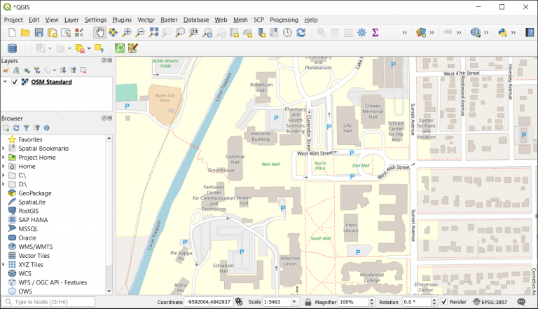
Web > QuickMapServices > OSM > OSM Standard
Although the standard OSM basemap is free to use, an API key is required for any of the following:
- Cycle Map
- TF Landscape
- TF Outdoors
- TF Transport Dark
- Transportation
- Veloroad
These base maps provide specific information for cyclists, transportation, and outdoor enthusiasts. But 99% of people won’t require an API if it’s just for basic usage.
Extracting OSM data
If you want to extract raw OSM data, you should know it’s available in a variety of formats which allows for easy integration into a variety of software applications.
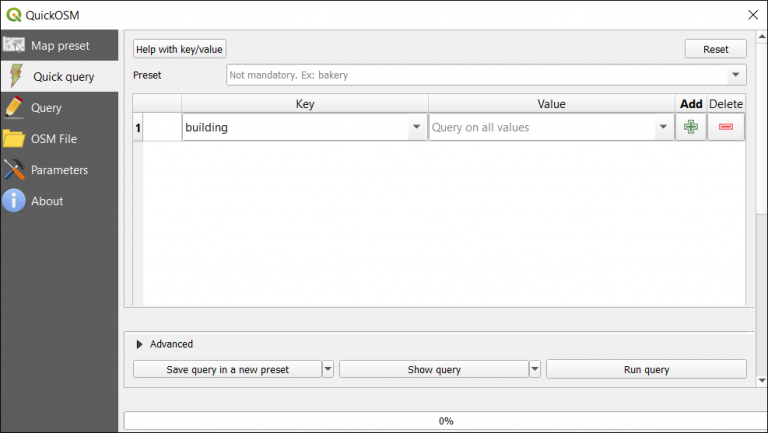
Although there are other ways to download OSM data, one of the easiest methods is using the QuickOSM plugin. First, you will have to download and install the QuickOSM plugin. Next, you can access the plugin in the menu via:
Vector > QuickOSM > QuickOSM
OpenStreetMap uses mapping values to categorize features in the OSM database. First, OSM data has a primary key which is a categorical type of feature (such as “highway”). But you can also get more detailed features which are the value (such as “motorway”, “trunk”, “primary”, or “secondary”).
- Key – Highways
- Value – Motorway, trunk, primary, secondary, etc
You’re going to enter the OSM keys and values for all the features you want to download. But if you want to query all the values within a key, make sure that you don’t enter anything in the second field.
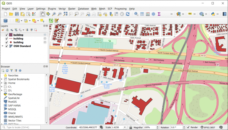
Next, you run the query to retrieve all the OSM features you specified in the map canvas. But this won’t save them to memory unless you save them.
For any features that you want to save, right-click layers in the map and click the following:
Export > Save Features As > Shapefile
QGIS OpenStreetMap: OSM Plugins for QGIS
OpenStreetMap is a free, editable map of the world that anyone can use. Using OSM data in QGIS enables you to easily create maps with layers for roads and buildings, and also features vector-based rendering.
The OpenStreetMap project is supported by many volunteers around the globe who are dedicated to geodata collection, processing, and distribution. Plus, QGIS provides an easy way to integrate OSM data into any project.
In this article, we showed you how to download OSM data so that you can make use of it in your QGIS project.
Plus, we’ve provided simple instructions on how to import OSM data into a QGIS project as a simple basemap using the QuickMapServices plugin.


