Lakes and Rivers Map of the United States
Download our lakes and rivers map of the United States. It’s free to use for any purpose. Or select from any of the 50 states for detailed lakes and rivers.
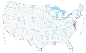
Download our lakes and rivers map of the United States. It’s free to use for any purpose. Or select from any of the 50 states for detailed lakes and rivers.
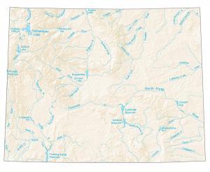
A map with major rivers, reservoirs and lakes in Wyoming like Yellowstone Lake, Snake River, Green River, and the North Platte River.
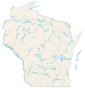
This map displays rivers, reservoirs and lakes of Wisconsin like Wisconsin River. Rivers flow into the Mississippi River and the Great Lakes.
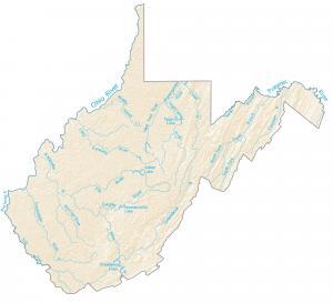
In this map, you will find major rivers, reservoirs, and lakes of West Virginia like Summersville Lake and the Ohio River.
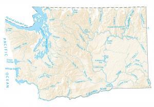
This map shows major rivers, reservoirs and lakes of Washington like Lake Chelan. The rivers and streams of Washington flow into the Pacific Ocean.
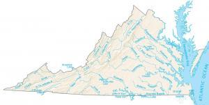
The largest lakes in Virginia are Kerr Lake, Smith Mountain Lake, and Lake Gaston. The Chesapeake Bay is the largest inlet in the eastern USA
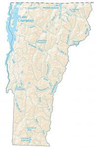
In this map, you will find major rivers, reservoirs and lakes of Vermont like Lake Champlain. The rivers of Vermont flow into the Atlantic Ocean.
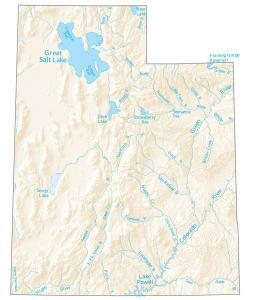
In this map, you will find major rivers, reservoirs and lakes of Utah like Great Salt Lake. Rivers of Utah flow into the Gulf of California and Great Basin.
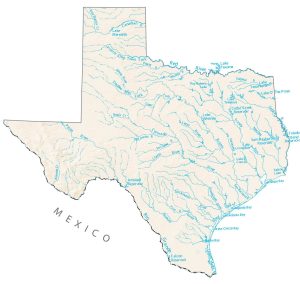
In this lakes and rivers map, you will find major rivers, reservoirs and lakes of Texas like Lake Texoma and Amistad Reservoir.
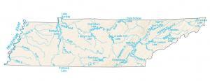
In this map, you will find major rivers, reservoirs and lakes like the Tennessee River. Most rivers head west toward the Mississippi River.