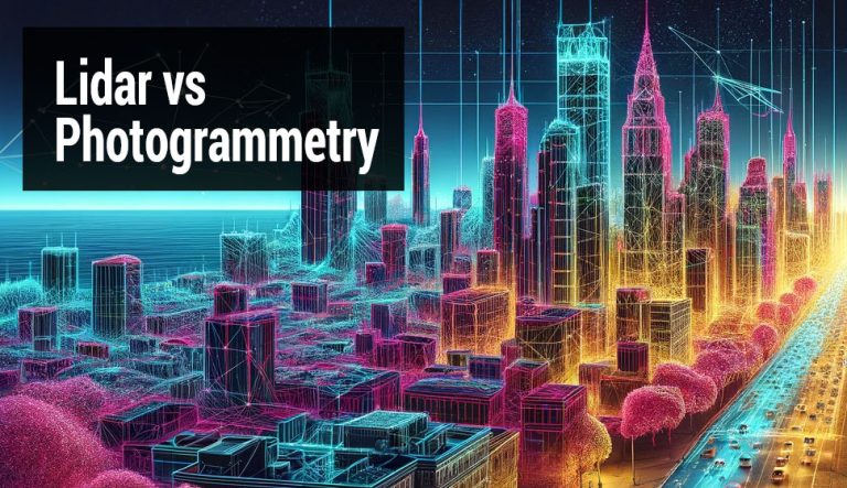
LiDAR vs. Photogrammetry: A Guide to Mapping Technologies
What is the difference between LiDAR and photogrammetry?
LiDAR and photogrammetry are both ways to map the Earth, but they do it a bit differently. LiDAR uses lasers to measure distances. Photogrammetry, on the other hand, uses photos from different angles to create 3D models.
LiDAR Accuracy
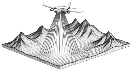
Light Detection and Ranging (LiDAR) is known for its high precision in capturing elevation data. While LiDAR can achieve a vertical accuracy of up to 5-15 cm, horizontal accuracy is up to 10-30 cm(1)(2)(3).
LiDAR achieves this level of accuracy because it uses laser pulses. It directly measures the distance between the sensor and the ground or objects.
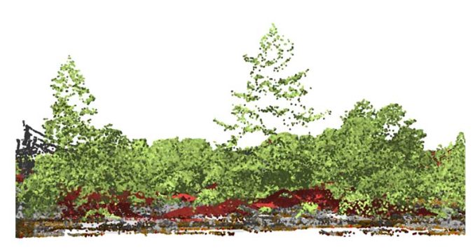
Further to this, LiDAR can penetrate dense vegetation. This makes it ideal for forested areas or areas with heavy vegetation cover. Here are some other LiDAR use cases and applications.
Photogrammetry Accuracy
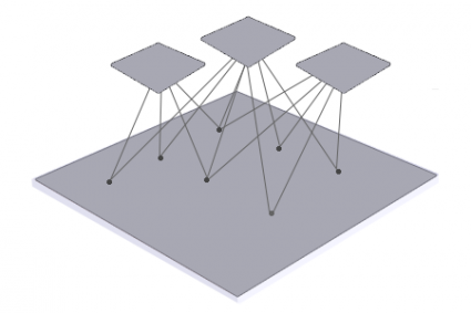
The consensus is that photogrammetry doesn’t have as much accuracy as LiDAR. This is because it relies on overlapping images taken from different angles to create 3D models.
Under general conditions, the accuracy of photogrammetry is not as high as LiDAR. But if you take a lot of overlapping photos, a photogrammetric DEM can be just as accurate as LiDAR.
Factors such as image quality, camera calibration, and the precision of ground control points all come into play. This includes the technical expertise of the photogrammetrist and photogrammetry software.
Is LiDAR more accurate than photogrammetry?
LiDAR tends to be more accurate than photogrammetry. This is especially true for measuring elevations with dense vegetation. LiDAR peers through trees to the ground. Whereas photogrammetry stitches together overlapping photos at different angles.
LiDAR‘s laser accuracy “sees” through the foliage. Imagine standing in the middle of a forest. When you look up, can you see sunlight? If you can see sunlight, that means LiDAR can peer through the forest as well.
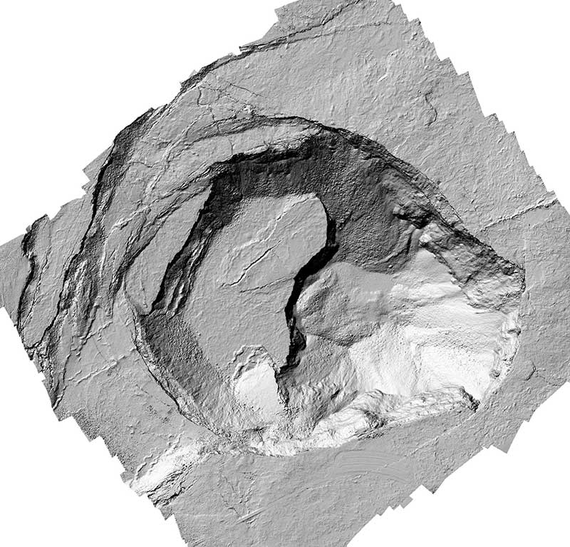
Depending on the thickness of vegetation, photogrammetry can struggle in forested areas. But LiDAR is capable of detecting what is invisible to the human eye. For example, LiDAR has discovered hidden features like ancient ruins. This was not possible to do with standard imaging techniques.
DID YOU KNOW?
Researchers used LiDAR to discover the ancient Mayan city of La Ciudad Blanca, hidden for centuries in the Honduran jungle.
Applications and use cases
Now that you have a bit of background on the accuracy of LiDAR vs photogrammetry, what are their use cases? Here are some scenarios where each of these shines due to their unique capabilities.
LiDAR Use Cases
Depending on the project’s needs, one might choose LiDAR for its 3D modeling accuracy. As mentioned earlier, it is especially accurate in vegetated environments.
- Forestry Management: LiDAR can measure forest canopy and density with its number of returns.
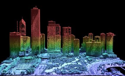
- Urban Planning: Helps in detailed mapping of cityscapes, including buildings, roads, and infrastructure.
- Flood Modeling: By accurately mapping terrain, LiDAR helps create flood risk models.
- Archaeology: Can reveal ancient civilizations beneath dense vegetation, without excavation.
- Autonomous Vehicles: LiDAR sensors are crucial for obstacle detection in self-driving cars.
Photogrammetry Use Cases
LiDAR provides precise elevation data by penetrating vegetation. Whereas, photogrammetry captures textures of surfaces and can be a more cost-effective option.
- Cultural Heritage Documentation: Creates photorealistic 3D models of historical monuments for preservation.
- Film and Video Game Production: Generates 3D virtual environments with realistic textures.
- Real Estate and Architecture: Offers photorealistic models of buildings and landscapes.
- Construction Monitoring: Tracks changes and creates as-builts from photogrammetric surveys.
- Environmental Monitoring: Assesses changes in landscapes, erosion, and vegetation over time.
Advantages and disadvantages of LiDAR and photogrammetry
LiDAR and photogrammetry are both powerful tools that we use in mapping and surveying. Here are the advantages and disadvantages of both types of technologies.
| Aspect | LiDAR | Photogrammetry |
| Accuracy | High accuracy, especially in vertical dimensions. | Accuracy depends on factors like camera quality and conditions during image capture. Generally less accurate than LiDAR for vertical measurements. |
| Cost | Typically, it has a higher cost due to its equipment and processing. | Generally more cost-effective, especially for smaller projects with existing images. |
| Terrain Penetration | Can penetrate vegetation to some extent, providing data on ground surfaces under forest canopies. | Limited by line of sight; cannot penetrate dense vegetation or capture ground surfaces underneath. |
| Data Collection Speed | Fast data collection over large areas. | Can be time-consuming, especially for large areas, as it requires multiple images from different angles. |
| Light Conditions | Can operate day or night since it uses its light source. | Requires sufficient natural light, limiting data collection to daytime and suitable weather conditions. |
| Data Processing | Complex data processing is required to interpret the raw data. | Relatively simpler processing, especially with advances in software. However, photogrammetric processing can still be intensive for large datasets. |
| Versatility | Highly versatile for various applications, including topography, forestry, and urban planning. | Highly versatile and widely used in mapping, surveying, and creating 3D models for various industries. |
| Detail Resolution | Provides detailed elevation data but might lack the texture and color information that images provide. | Captures high-resolution images that include color and texture. |
Choosing Between LiDAR vs Photogrammetry
The choice between LiDAR vs photogrammetry depends on the specific requirements of your project.
I prefer LiDAR for projects that demand high accuracy and precision. This is especially true for areas with dense vegetation and its ability to penetrate tree cover.
Photogrammetry is more cost-effective, especially if overlapping photos already exist. This makes it suitable for projects where texture and less accuracy are sufficient. But keep in mind it’s not ideal for areas with dense vegetation.
Both technologies have their unique advantages. You can also use them together to leverage the strengths of each method.


