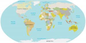
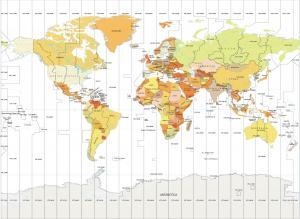
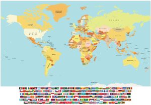
World Map with Latitudes and Longitudes

You are free to use our world map with latitude and longitudes for educational and commercial uses. Attribution is required. How to attribute?
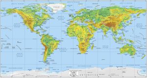
World Map with Latitudes and Longitudes
Download this free world map with latitudes and longitudes to help you identify the coordinates of any place on Earth.
It can be a great resource for students, teachers, and professionals who need to know the general locations of cities or countries in the world.
Keep in mind that our world map with latitudes and longitudes is completely free to use. You can use it for educational and commercial purposes.
What are Latitude and Longitude?
We use latitudes and longitudes to identify the exact location of a place on Earth. You need a set of two coordinates to represent a location, which includes latitude and longitude.
Latitude represents the distance north or south of the equator, while longitude is the distance east or west of the Greenwich Meridian. Latitudes are represented by an angular distance between 0° and 90° north or south of the equator while longitudes are represented by an angular distance between 0° and 180° east or west of the Greenwich Meridian.
What is Latitude?
Latitudes are measured in degrees with the equator as a latitude of 0°. While the North Pole is 90° north of the equator, the South Pole is 90° south of the equator.
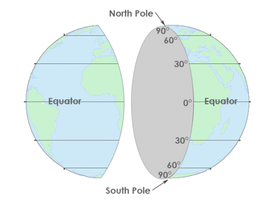
As you travel towards the equator from the north or from the south, the latitude will get smaller. For example, Florida has a latitude of about 27° north, which means it is 27 degrees north of the equator.
What is Longitude?
Longitude is a geographic coordinate that specifies the east-west position of a point on the Earth’s surface. Similar to latitude, it is an angular measurement.
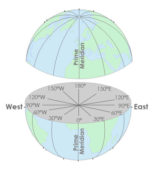
But longitude is measured relative to the Prime Meridian. The Prime Meridian is located at 0° longitude, while the opposite side of the globe is located at 180° longitude.
For example, the longitude of New York City is 74° W, which means that it is located 74° west of the Greenwich meridian.
Conclusion
Having a world map with latitudes and longitudes is incredibly beneficial, as it allows us to identify geographic locations on the Earth.
Our world map has 30° intervals for both latitude and longitude so you can’t have an incredible amount of accuracy. Instead, it’s good for pinpointing anything from the size of a country or state to a city.
We hope you enjoy our world map with latitude and longitude lines. Remember that you can download this map for free and use it for any purpose.