Location-Allocation in ArcGIS (Site Selection)
How to choose an optimal site for your business
Where should you build your store?
Location is the #1 factor for the success of a business.
Because when businesses know where their customers are located, they naturally have customers rolling in like clockwork.
So how do you find an optimal business location? Where should you locate a municipal or city service?
Enter the location-allocation tool – a handy tool using the ArcGIS network analyst.
What is location allocation?
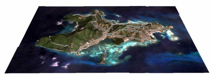
If you were the mayor of an island with the following population distribution:
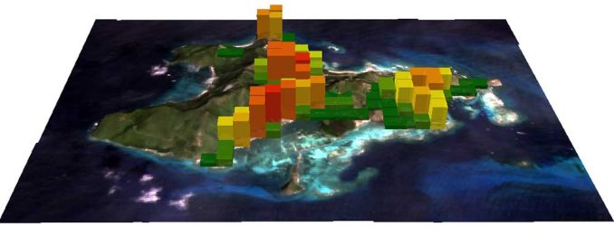
…and your island has no fire stations.
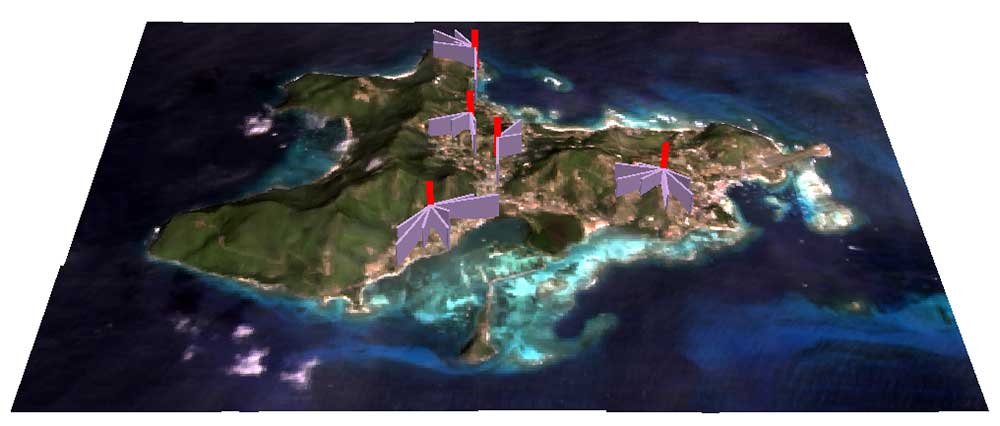
If you had the chance to locate 5 fire stations to maximize coverage, where would you put them?
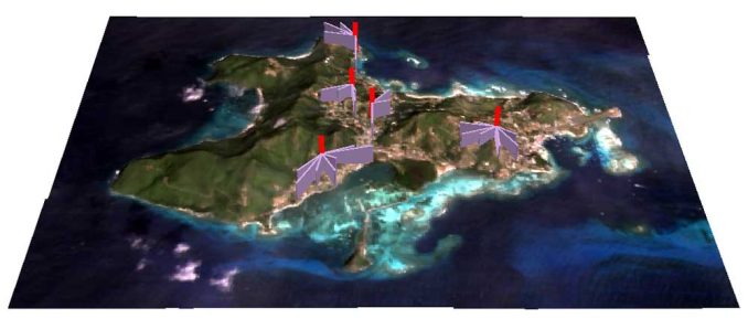
Here’s where I would put them shown as the red extruded points:
But how did I know where to put them?
I used the location-allocation tool because it answers how to serve demand in optimal locations.
Here’s how you can use it too:
What you will need
There are three must-have layers you need to run the location-allocation tool:
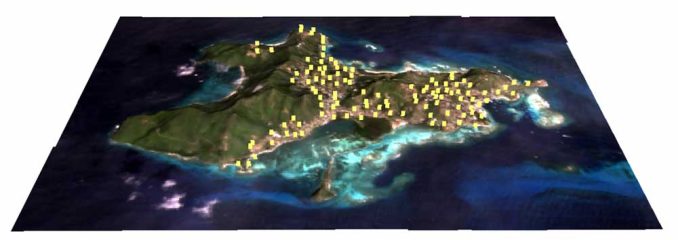
DEMAND POINTS: Inputs are points of demand with a weight such as population per point. Where is your population? Or where are potential customers located? Add a weight field if there is more than one per point. Examples of free demand GIS data could be from TIGER census data, SEDAC socio-economic data, Esri’s tapestry segmentation, and your local city/municipal sources.
FACILITIES: The input is a point file with a facility type defining if it’s a candidate, required, competitor, or chosen site. Where are existing facilities located? Or where can candidate facilities be placed? If candidate facilities are everywhere, then you can run the fishnet tool to create evenly-spaced points in your area of interest.
NETWORK DATA SET: Input is a road network with connectivity rules. What is the current road network? To get the network toolbar enabled, you need a road network data set part of a geodatabase. Check out this services area tutorial to learn how to make one.
Run the location-allocation tool
Turn on your Network Analyst extension. Add your road network data set. In the Network Analyst toolbar, click Network Analyst > New Location Allocation.
Load your demand points and facilities. Choose the type of problem in the advanced setting drop-down. From here, all you need to do is solve
One of the most powerful features is how you can solve different types of location allocation problems.
For example:
MINIMIZE IMPEDANCE: Good for warehouse problems because it selects optimal locations based on impedance to the facility.
MAXIMIZE COVERAGE: Good for fire hall problems because facilities are chosen based on the greatest demand within an impedance cut-off.
MARKET SHARE: This takes into account competing facilities using gravity models to determine the proportion of demand at each candidate facility.
MINIMIZE FACILITIES: This allocates the minimum number of facilities so demand is served given an impedance cut-off.
Other types of solutions are for maximizing-capacitated coverage, targeting market share, and maximizing attendance.
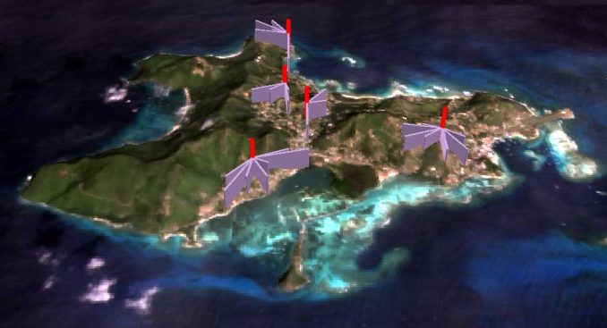
The above location-allocation analysis shows 5 optimal locations (red) for fire stations within this island. As location-allocation attempts to maximize coverage, purple lines represent how far their services can reach.
IMPEDANCE VALUES: This can be interpreted as how far people are willing to travel to or from a given facility. For example, when you enter an allowable distance of 5 miles, this is the length a fire department would go to reach a community.
This location-allocation solution runs the maximize coverage type of problem.
What’s next?
Given existing facilities, location-allocation helps business owners decide where the optimal location should be.
You can even add competing stores to the target market share.
If you were to use one tool to decide the optimal location for a successful business, it would be the location-allocation tool in ArcGIS.
ArcGIS has developed a gem to allocate facilities based on demand.
Alternatively, you can predict how many customers will patron your store using the Huff Gravity Model.


How do I locate facilities and population data on the map?
How do i use this tool to analyse telecom market share and network expansion?
How do I prepare demand points for fire stations and what are the input data used for demand points. Thanks
It can be used for service like health facilities too I am transponding your basic information . kindly see and suggest
DEMAND POINTS: Input demand in relation to population per point. ie. the availability of land, water and energy in relation to population ie. the potential users/ beneficiaries are located? The availability of land, its area, terrain, topography, proximity to approach roads. For this GIS data could be matched with census and reflected against socio-economic data SEDAC in the local city/municipal sources etc.. Water source, must reflect the quantum and quality required with possible seasonal variation, festivities etc. Waste management has to be part of water use. Energy, its availability and usage as per season, climate and demand [maximum possible in demand must be identified]
FACILITIES: Depends on its level/ status (if it is a primary facility or stage 1 or stage II support system. Facility defining type of support, supply or maintenance required, and site where the support facility exists. Where are existing facilities located? Or where can candidate facilities be placed? If higher/ support facilities are more ensure that they are evenly-spaced nearest to the points / area of interest.
LINKAGE (both virtual and physical) like access to COMMUNICATION NETWORK like internet, road and transport AND access to support, supply and maintenance around each service Centre. The current road network can be enabled with tool bar data set as part of a geodatabase. Check out their service areas and tutorial to learn how to make one.
I tried to solve a location allocation problem connecting demand to the facility and also achieve maximise the market share by addition of new facilities, after I ran the program, I got the following error message for some demand points: “Warning: Demand Points (Name = “Location 15″) has a weight that is less than or equal to zero”. What can I do to resolve this problem? Thanks
Can a similar procedure be implemented in QGIS?