Map of Georgia – Cities and Roads
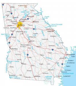
This map of Georgia contains cities, roads, rivers and lakes. Atlanta, Augusta and Columbus are some of the major cities shown in this map of Georgia.
This map of Georgia contains cities, roads, rivers and lakes. Atlanta, Augusta and Columbus are some of the major cities shown in this map of Georgia.
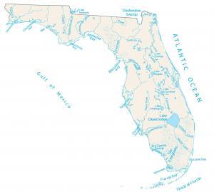
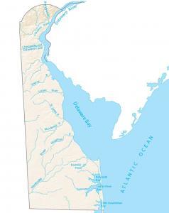
In this map, you will find major rivers, lakes and bays in the state of Florida. Rivers in Florida flow into the Atlantic Ocean and the Gulf of Mexico.
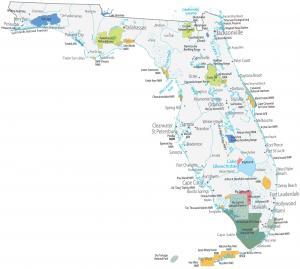
This Florida State Map displays major landmarks, federal lands and populated places. It includes national parks, forests, military bases in Florida.
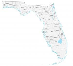
This Florida county map displays its 67 counties. Miami-Dade, Broward and Pinellas are the most populated counties in Florida.
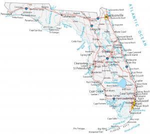
This Florida map shows cities, roads, rivers and lakes. Miami, Orlando and Jacksonville are some of the major cities shown in this map of Florida.
In this map, you will find major rivers, bays and lakes of Delaware like Delaware Bay. Rivers and streams of Delaware flow into the Atlantic Ocean.
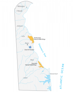
This Delaware State Map displays major landmarks and places in Delaware. It includes national wildlife refuges, military bases and federal lands.
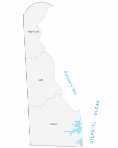
This Delaware county map displays its 3 counties. New Castle, Kent and Sussex are the only 3 counties that exits in Delaware.
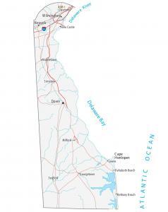
This Delaware map displays cities, roads, rivers and lakes. Dover, Newark and Wilmington are some of the major cities shown in this map of Delaware.
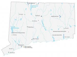
This Connecticut State Map shows populated places and major landmarks such as wildlife refuges, Indian reservations, lakes, cities and towns.