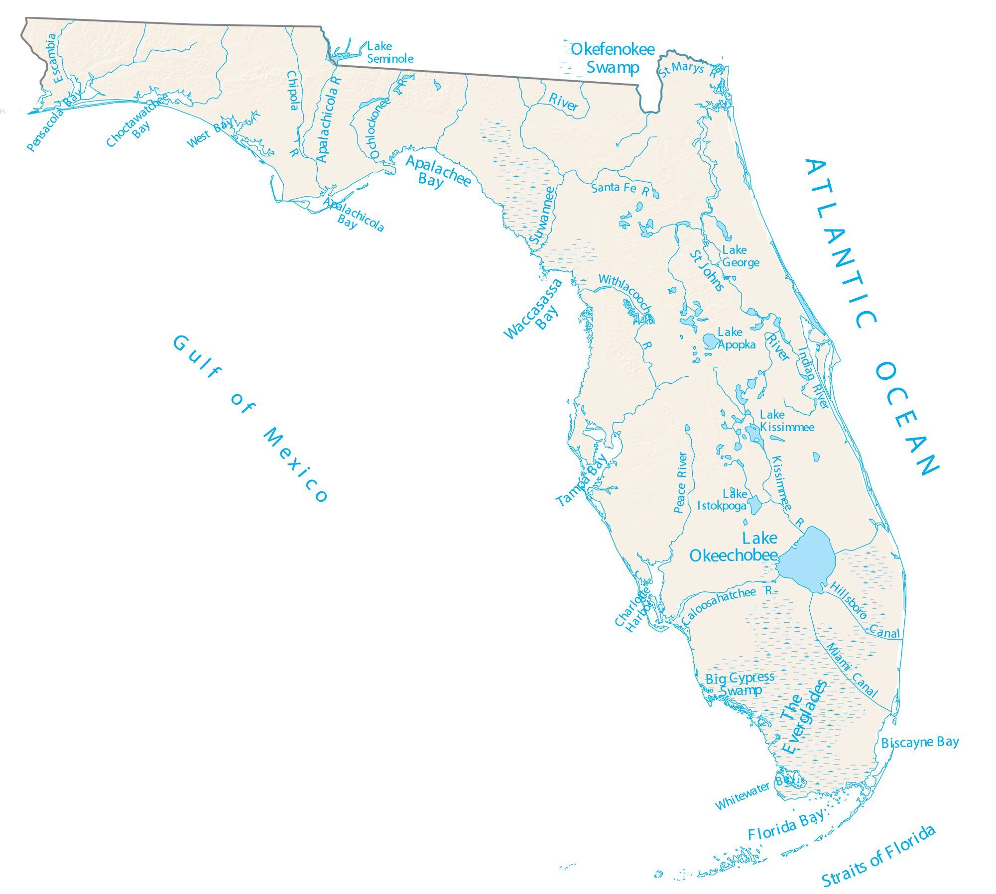
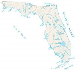
Florida Lakes and Rivers Map
About the map
On this map, you will find major rivers, lakes, and bays in the state of Florida. Overall, most rivers flow either east to the Atlantic or south.
In the south of Florida, the Florida Keys is a string of islands that stretch 120 miles off the coast. These islands are recognized for their exceptional fishing and scuba diving. Rivers in Florida flow into the Atlantic Ocean.
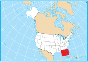
Other than its boundaries with Georgia and Alabama, Florida is completely surrounded by water. On the west coast, you’ll find several bays like Tampa Bay, Waccasassa Bay, and Florida Bay. Then on the east coast, it’s the Atlantic Ocean with everything from beaches to Cape Canaveral.
Florida map collection

You are free to use our map of Florida for educational and commercial uses. Attribution is required. How to attribute?
Florida lakes, rivers and reservoirs
Lakes and reservoirs
Lake Okeechobee
Lake Apopka
Lake George
Lake Seminole
Lake Istokpoga
Rivers and streams
St Johns River
Suwannee River
Apalachicola River
Peace River
Kissimmee River
Lake Kissimmee
Withlacoochee River
Santa Fe River
Escambia River
Chipola River
Ochlockonee River
Indian River
Caloosahatchee River
St Marys River
Bays
Biscayne Bay
Florida Bay
Tampa Bay
Apalachee Bay
Waccasassa Bay
Pensacola Bay
Choctawatchee Bay
West Bay
Apalachicola Bay
Whitewater Bay
Water Features
Okefenokee Swamp
Big Cypress Swamp
Canals Miami Canal
Hillsboro Canal
Charlotte Harbor
Straits of Florida
The Everglades

Looking for a navigational chart for the Sopchoppy River in Wakulla County Florida also the Oaklocknee River Florida