ArcGIS Earth: Discover the World
An Introduction to ArcGIS Earth
ArcGIS Earth opens up a world of possibilities for anyone from early learners to professionals, from students to teachers. It’s like Google Earth, but with a lot more data and other key features.
This beginner’s guide will help you navigate through the program with ease and get started on your path to exploring the globe.
Discover some of the key features of this standalone application by leveraging tips on how to use it.
This guide is designed to help beginners get started with ArcGIS Earth and use it like a pro. You will learn what the program is, how it works, and some of its neat features. Let’s get started.
What is ArcGIS Earth?
ArcGIS Earth is a standalone program that allows you to analyze, visualize, and share your data. Anyone can use it for mapping, basic spatial analysis, and geo-visualization of geographic data. It’s also used for managing and publishing GIS projects. You can download ArcGIS Earth for free from the Esri website.
The Basics of Getting Started
ArcGIS Earth is a platform that allows you to perform spatial analysis and visualize results in a variety of formats – such as maps, graphs, and 3D. You can use this software for many different purposes such as:
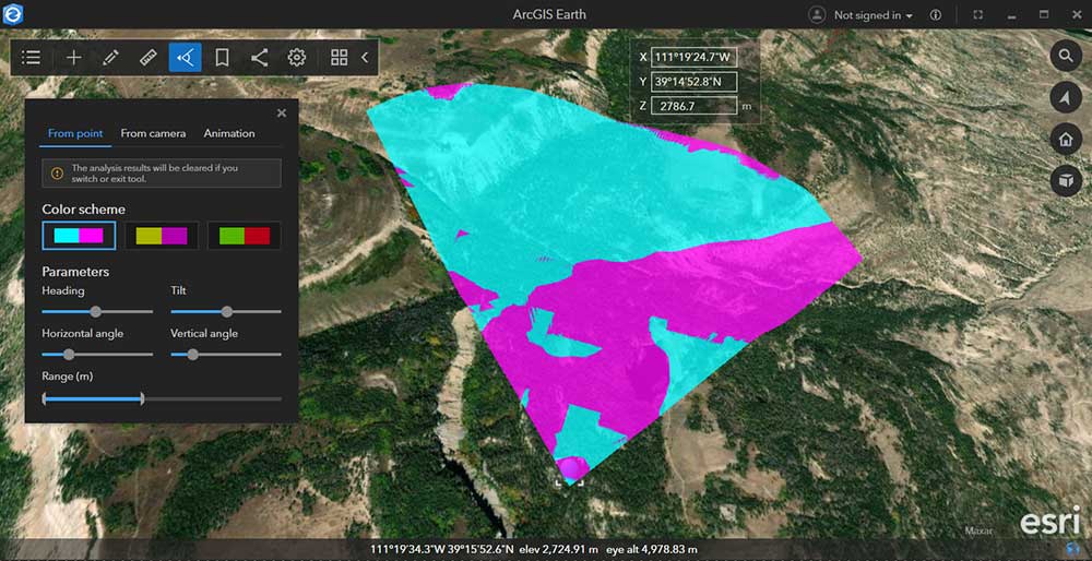
You can also use this software to view your own data in different ways such as dynamic viewsheds overlaid on terrain surfaces. All these things are possible using ArcGIS Earth. But before we get into how to use the software, let’s take a look at some of the basics of getting started.
Tools
From performing visibility analysis to creating and sharing geotagged photos, here are some of the key tools and functionality to help you work in ArcGIS Earth.
Although it shares a lot of similarities with Google Earth, it does not have Street View built-in so you can’t get a true view at road level. But if you have a Google API key, it’s possible to integrate it within ArcGIS Earth.
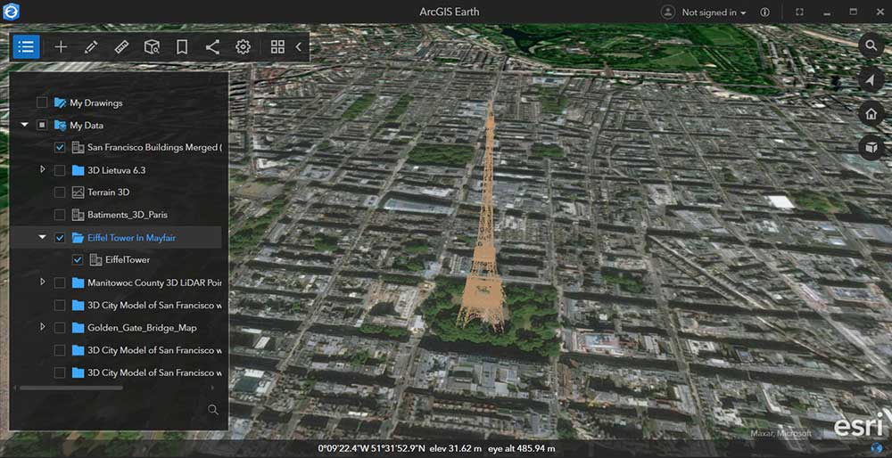
Data Layers
ArcGIS Earth provides access to browse local files. For example, you can upload your data in any of the following formats:
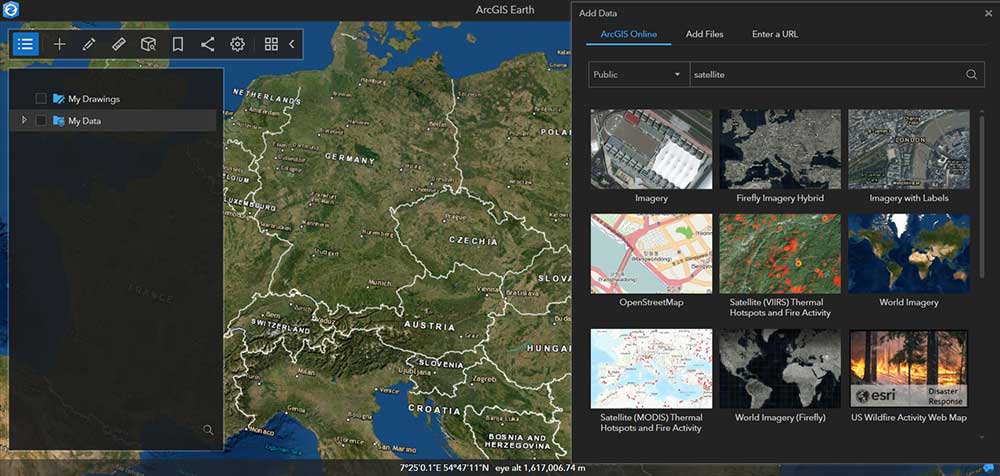
But in addition to local files, you can also access a whole host of data from online sources through Esri such as with the Living Atlas of the World or ArcGIS Online.
Having access to this much data allows you to experience the world with your eyes and use your own senses to find your way around. Although it does not have support for attribute tables, you can access web scenes, map services, image services, scene services, and feature services.
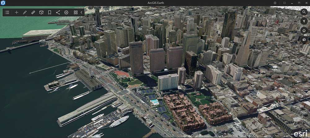
3D Integration
You might think of the world as a giant flat map. But if you think of it as a three-dimensional world, you can get a much better sense of what’s going on.
One of the key features that make ArcGIS Earth an interactive global view is its 3D integration and realistic rendering.
But it might take a bit of searching in order to find what you’re looking for. ArcGIS Online provides you with 3D data from various sources. But finding what you want can be a challenge.
Although the technology is improving, you won’t find as many 3D buildings or meshes compared to Google Earth. But it’s still one of our top 3D applications for mapping.
ArcGIS Earth App
ArcGIS Earth is a powerful tool that helps you visualize, explore, and share your GIS data. It’s easy to get started and you can use it anywhere even on a mobile phone
The app is currently available on iOS, Android, and Windows platforms. Further to this, you can download it through either the App Store or Google Play.
By using your touch display, it’s possible to pan, move, or zoom in and out with a single finger. If you use two fingers and slide up or down, you tilt your view for a 3D display.
It’s also possible to record GPS tracks, which can be a handy tool if you’re out in the field. Afterward, you can export it as a KMZ/KML for other uses in any GIS software.
Summary: ArcGIS Earth
With ArcGIS Earth, the world is your oyster! It’s an innovative platform with a range of possibilities.
For instance, you can create interactive maps using 3D, a wide range of analysis tools, or even take them with you on your mobile phone.
One of its biggest advantages is its integration with ArcGIS Online. Because you can access this massive GIS data portal, you can access hundreds of datasets such as from the Living Atlas of the World.
Have you tried ArcGIS Earth and what did you think of it? Please let us know what you think in the comments form below.


