What Is ArcGIS Server?
What Is ArcGIS Server?
ArcGIS Server is a technology that enables anyone to publish web mapping services and consume them on the internet.
These published web mapping services can be accessed through Desktop GIS applications or online without having to install special software.
For instance, users can access web mapping services in ArcGIS Desktop or Pro, ArcGIS Online, and other web client applications as a map image layer or a feature layer.
The ArcGIS Server technology has been available since 2004 and it continues to be a convenient way to share map layers through the web. Let’s examine ArcGIS Server in more detail.
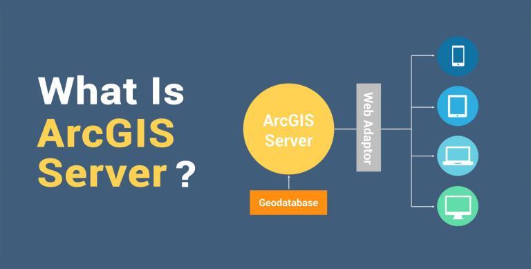
Enterprise and ArcGIS Server Architecture
In the grand scheme of things, ArcGIS Server is a back-end component part of ArcGIS Enterprise. ArcGIS Server allows anyone to centrally manage, publish and serve map layers online.
Then, the browser is the client-side (front-end component) that you can use to call the web services from ArcGIS Server.
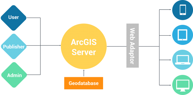
This communication between the server and client happens through HTTP requests from the client to server. This is where the REST API applies.
Each web mapping service that is published through ArcGIS Server has a REST endpoint, which is how the client can gain access to it.
Web Mapping Service Types
Under the hood, it’s ArcGIS Server that helps you centrally manage and publish web mapping services. Web mapping services (WMS) are hosted on the internet and governed by standards set by the Open Geospatial Consortium (OGC).

They come in a variety of different formats such as WMS, WFS, WCS, WPS, WMTS, and WCPS. Each one has a specific usage for serving data online.
Based on the type of web service you publish, it’s ArcGIS Server that controls whether or not you can edit the features, tile caching, and more.
If you want to learn more about the different types of web mapping services, you should try reading our article – An Introduction to Web Mapping Services (WMS). You can also find more information on the different types of GIS formats, including web standards.
How do you create a map service?
If you want to publish a web mapping service for others to access, it’s possible to share the entire map contents or individual feature classes. From the main menu, you can click:
In ArcGIS Desktop
File > Share As > Service > Publish Service
In ArcGIS Pro
Publish Ribbon > Map Service
From here, it will take you through a wizard on finalizing the publication of your web mapping service. There are a lot of options for customization so be careful to choose the correct settings.
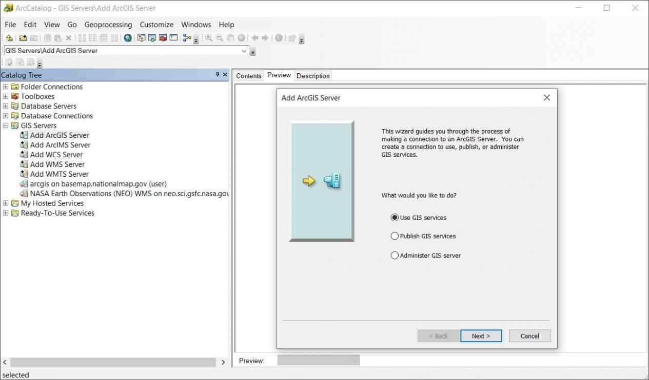
How do you access a map service?
It’s easy to access web mapping services in a Desktop GIS application like in ArcGIS Desktop or Pro. You typically establish the server connection in the ArcCatalog pane:
In ArcCatalog:
Catalog > Add ArcGIS Server > Use GIS Services
Remember that once you publish a service online, it’s through the client that you access the map layer. By using the URL of the REST endpoint, it’s how you can call any published service.