Washington Lakes and Rivers Map
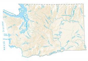
This map shows major rivers, reservoirs and lakes of Washington like Lake Chelan. The rivers and streams of Washington flow into the Pacific Ocean.
This map shows major rivers, reservoirs and lakes of Washington like Lake Chelan. The rivers and streams of Washington flow into the Pacific Ocean.
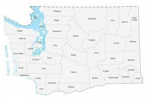
This Washington county map displays its 39 counties. King County, Pierce County and Snohomish County have the highest population.
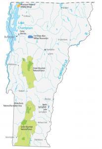
This Vermont State Map shows major landmarks and places in Vermont like national forests, military bases, wildlife refuges and federal lands in Vermont.
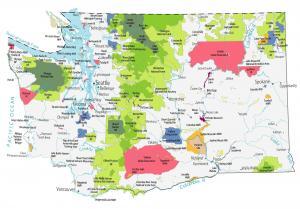
This Washington State Map shows major landmarks in Washington like national parks, forests, monuments, scenic areas, military bases and more.
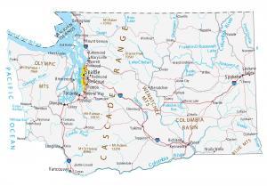
This Washington map contains cities, roads, rivers and lakes. Seattle, Spokane and Tacoma are major cities shown in this map of Washington.
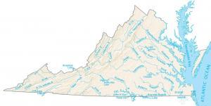
The largest lakes in Virginia are Kerr Lake, Smith Mountain Lake, and Lake Gaston. The Chesapeake Bay is the largest inlet in the eastern USA
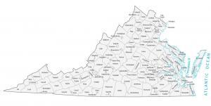
This Virginia county map displays its 95 counties and independent cities. Fairfax Count, Prince William County and Virginia Beach County are most populated.
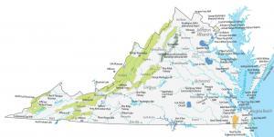
This Virginia State Map shows major landmarks in Virginia. It includes national forests, military bases, wildlife refuges and federal lands in Virginia.
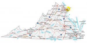
This Virginia map contains cities, roads, rivers and lakes. Virginia Beach, Norfolk and Chesapeake are major cities shown in this map of Virginia.
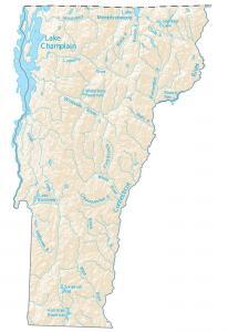
In this map, you will find major rivers, reservoirs and lakes of Vermont like Lake Champlain. The rivers of Vermont flow into the Atlantic Ocean.