Tennessee Lakes and Rivers Map
In this map, you will find major rivers, reservoirs and lakes like the Tennessee River. Most rivers head west toward the Mississippi River.
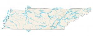
In this map, you will find major rivers, reservoirs and lakes like the Tennessee River. Most rivers head west toward the Mississippi River.
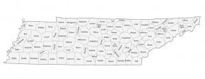
This Tennessee county map displays its 95 counties. Shelby County, Davidson County and Knox County are the most populated counties in Tennessee.
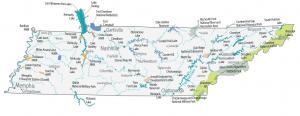
This Tennessee State Map shows major landmarks and places like national forests, parks, military bases, wildlife refuges and federal lands in Tennessee.
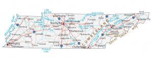
This Tennessee map contains cities, roads, rivers and lakes. For example, Nashville, Memphis and Knoxville are major cities in this map of Tennessee.
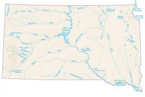
In this map, you will find major rivers, reservoirs, and lakes of South Dakota. They include Lake Oahe, Lake Sharpe, and Lake Francis Case.
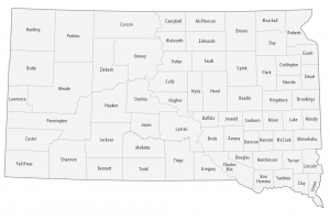
This South Dakota county map displays its 66 counties. Minnehaha County, Pennington County and Lincoln County are most populated in South Dakota.
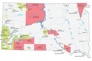
This South Dakota State Map shows major landmarks and places in South Dakota like national forests, military bases, wildlife refuges and federal lands.
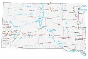
This South Dakota map contains cities, roads, rivers and lakes. Sioux Falls, Rapid City and Pierre are major cities in this map of South Dakota.
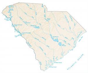
In this map, you will find major rivers, reservoirs and lakes of South Carolina like Lake Marion. Rivers of South Carolina flow into the Atlantic Ocean.
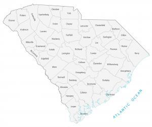
This South Carolina county map displays its 46 counties. Greenville, Richland and Charleston county are the most populated counties in South Carolina.