Michigan Lakes and Rivers Map
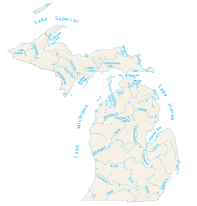
In this map, you will find major rivers, reservoirs, streams, bays and lakes in Michigan. More than 50% borders the Great Lakes.
In this map, you will find major rivers, reservoirs, streams, bays and lakes in Michigan. More than 50% borders the Great Lakes.
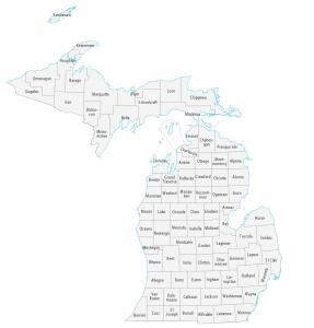
This Michigan county map displays its 83 counties. Wayne, Oakland and Macomb are some of the largest counties in Michigan in terms of population.
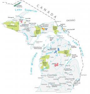
This Michigan State Map shows major landmarks and places in Michigan. It includes national forests, military bases, wildlife refuges and other federal lands.
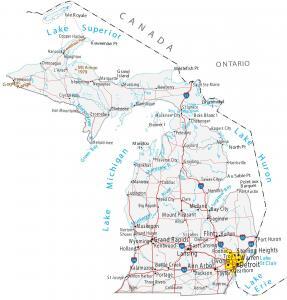
This Michigan map contains cities, roads, islands, mountains, rivers and lakes. Detroit, Grand Rapids and Warren are major cities in this map of Michigan.
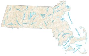
In this map, you will find major rivers, reservoirs and lakes of Massachusetts. It includes bays like Cape Cod, Massachusetts and Buzzards Bay.
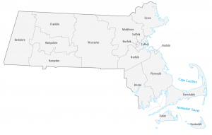
This Massachusetts county map displays its 14 counties. Middlesex, Worcester and Suffolk County are the most populated counties in Massachusetts.
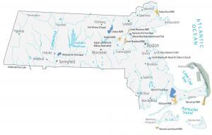
This Massachusetts State Map shows major landmarks, military bases, wildlife refuges and federal lands in Massachusetts like the Cape Cod National Seashore.
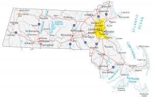
This Massachusetts map contains cities, roads, rivers and lakes. Boston, Springfield and Worcester are major cities shown in this map of Massachusetts.
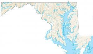
This map shows major rivers, reservoirs and lakes of Maryland like Potomac and Susquehanna River. Rivers in Maryland flow into the Atlantic Ocean.
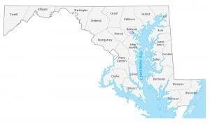
This Maryland county map displays its 23 counties and one independent city. Montgomery, Prince George and Baltimore are the most populated counties.