Idaho Lakes and Rivers Map
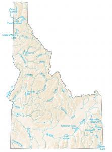
This map shows the major rivers and lakes of Idaho like the Snake, Salmon and Boise River. Rivers in Idaho flow into the Pacific Ocean and Great Basin.
This map shows the major rivers and lakes of Idaho like the Snake, Salmon and Boise River. Rivers in Idaho flow into the Pacific Ocean and Great Basin.
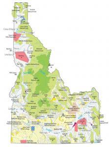
This Idaho State Map includes national parks & forests, military stations, national monuments, wildlife refuges and other federal lands.
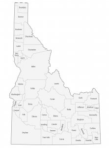
This Idaho county map displays its 44 counties. Ada, Canton and Kootenai are some of the largest counties in Idaho in terms of population.
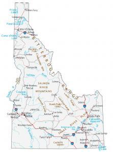
Boise, Meridian and Nampa are major cities shown in this map of Idaho. This Idaho map contains cities, interstate highways, rivers and lakes.
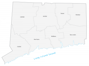
This Connecticut county map geographically displays its 8 counties. Fairfield, New Haven and Hartford are the most populated counties in Connecticut.
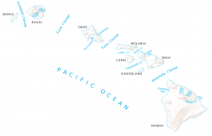
This map shows channels, rivers and bays of Hawaii like the Kauai, Kalohi and Pailolo channels. All rivers of Hawaii flow into the Pacific Ocean.
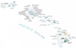
This Hawaii State Map shows major landmarks and places in Hawaii. It includes national parks, military bases, preserves, and wildlife refuges.
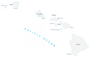
This Hawaii county map displays the 5 county divisions of Hawaii. Hawaii’s five counties include Kauai, Honolulu, Maui, Hawaii and Kalawao counties.
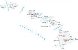
This Hawaii map displays the islands, cities and channels of Hawaii. Honolulu, Pearl City and Hilo are some of the major cities shown in this map of Hawaii.
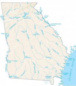
In this map, you will find rivers, reservoirs and lakes of Georgia like Hartwell Lake, the Altamaha River and Ogeechee River.