Map of Delaware – Cities and Roads
This Delaware map displays cities, roads, rivers and lakes. Dover, Newark and Wilmington are some of the major cities shown in this map of Delaware.
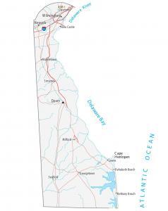
This Delaware map displays cities, roads, rivers and lakes. Dover, Newark and Wilmington are some of the major cities shown in this map of Delaware.
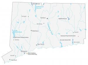
This Connecticut State Map shows populated places and major landmarks such as wildlife refuges, Indian reservations, lakes, cities and towns.
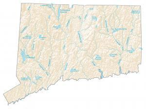
Rivers of Connecticut flow into the Atlantic Ocean. In this map, you will find major rivers, reservoirs, lakes and water features in the state of Connecticut.
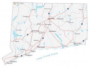
In this map of Connecticut, it displays cities, roads, rivers and lakes. Hartford, New Haven and Bridgeport are major cities shown in this Connecticut map.
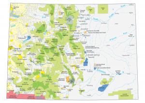
This Colorado State Map shows major landmarks and places. It includes national forests, military bases, preserves, wildlife refuges and other federal lands.
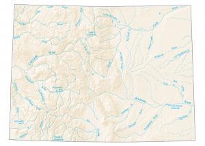
This map shows lakes and rivers like the Colorado River, Rio Grande and Arkansas River. Rivers in Colorado flow into the the Great Basin.
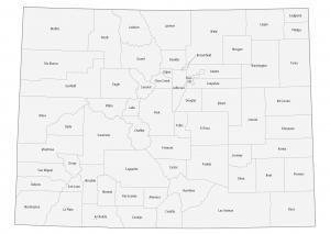
This Colorado county map displays its 64 counties. For example, Denver, El Paso and Arapahoe are the most populated in the state of Colorado.
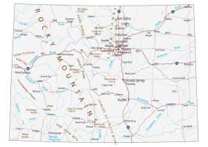
This Colorado map contains cities, roads, rivers and lakes. Denver, Colorado Springs and Aurora are the major cities shown in this map of Colorado.
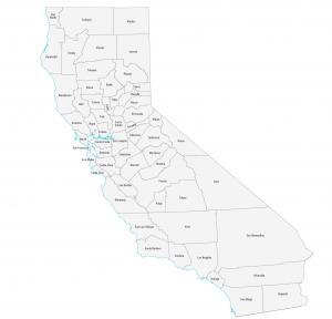
This California county map displays its 58 counties. For population, Los Angeles, San Diego and Orange county are the largest counties in California.
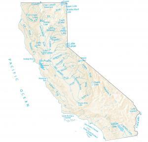
This California lakes and rivers map displays water features on California. All these rivers flow into the Pacific Ocean, Gulf of California and the Great Basin.