Map of Tajikistan
A Tajikistan map with cities, highways, imagery, and elevation – A landlocked country in Central Asia part of the Alay and Pamir Mountains.
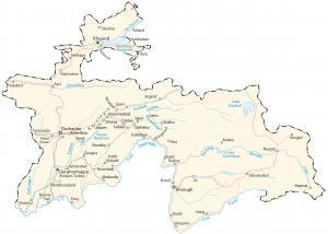
A Tajikistan map with cities, highways, imagery, and elevation – A landlocked country in Central Asia part of the Alay and Pamir Mountains.
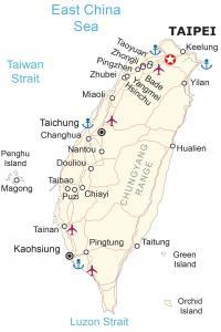
This Taiwan map shows cities, highways, water features, satellite imagery, and elevation. Taiwan is an island country in East Asia near China.
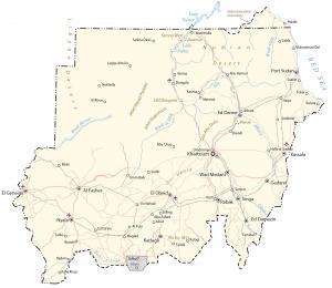
This Sudan map shows cities, highways, satellite imagery, and elevation. Sudan is a country located in northeast Africa along the Red Sea.
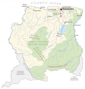
A Suriname map with cities, roads, imagery, and elevation – a South American country located in the northeast along the Atlantic Ocean.
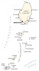
A map of St Vincent and the Grenadines – consisting of one main island (Saint Vincent) and a chain of smaller islands (The Grenadines).
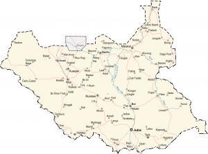
A South Sudan map with cities, highways, satellite imagery, and elevation. South Sudan is a landlocked country in east-central Africa.
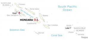
A Solomon Islands map – The Solomon Islands consists of six major islands and over 900 smaller uninhabited islands in Oceania.
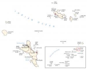
A map of Seychelles with places, roads, islands, imagery, and elevation – the African archipelago of about 115 islands in the Indian Ocean.
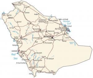
A map of Saudi Arabia with cities, highways, and water – Saudi Arabia is in the Arabian Peninsula, between the Red Sea and the Persian Gulf.
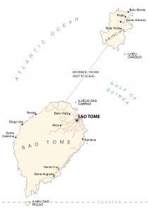
A map of Sao Tome and Principe with towns, villages, roads, water, imagery, and elevation – two main islands about 150 kilometers apart.