South Sudan Map
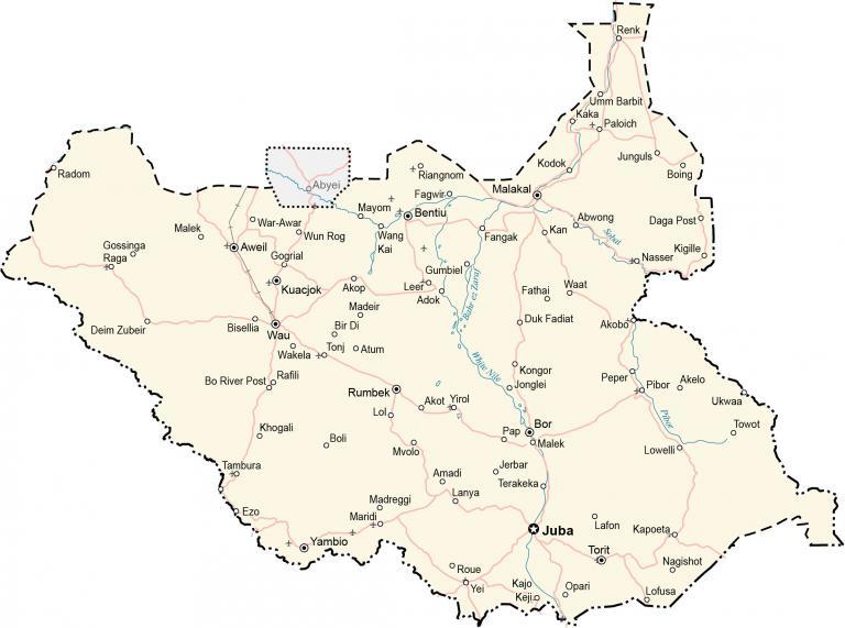
This South Sudan map (Republic of South Sudan) contains cities, towns, highways, roads, and airports. This South Sudan map collection contains a reference map, satellite imagery, and an elevation map.
South Sudan map collection
You are free to use our South Sudan map for educational and commercial uses. Attribution is required. How to attribute?
About the map
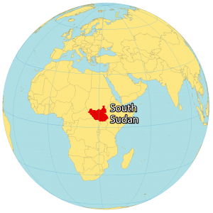
South Sudan is a landlocked country in east-central Africa. It borders Ethiopia to the east, Sudan to the north, the Central African Republic to the west, the Democratic Republic of Congo to the southwest, Uganda to the south, and Kenya to the southeast.
In 2011, South Sudan gained independence from the Republic of Sudan. Overall, this makes it one of the most recent sovereign states or countries. Juba is the capital and largest city of South Sudan. Other major cities are Malakal, Yei, and Wau.
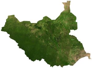
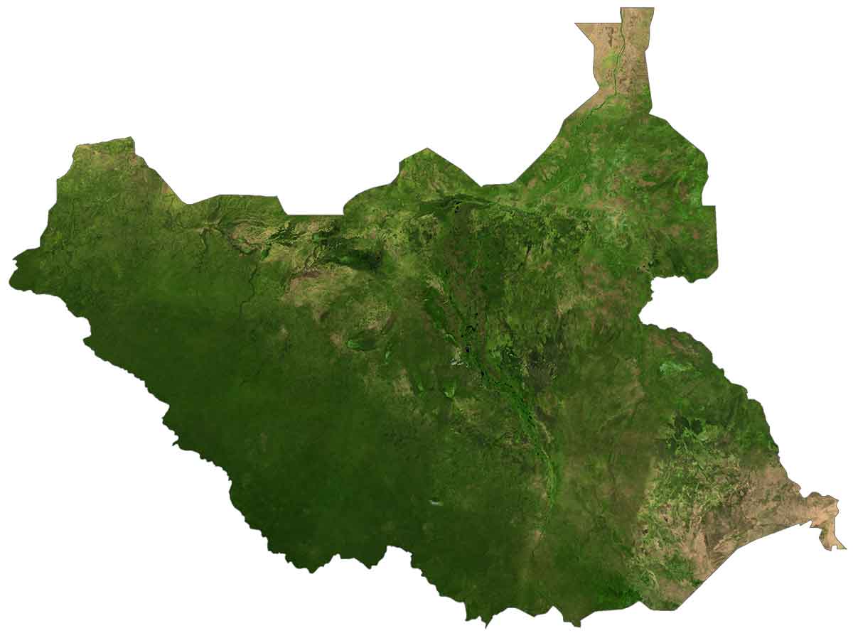
SATELLITE IMAGERY
South Sudan Satellite Map
South Sudan has a landmass of 644,329 square kilometers (248,777 sq mi). In comparison, this makes it larger than Somalia or the Central African Republic. The country is known for its diverse types of landscapes like its savannas, swamplands, and rainforests.
It lies between 3°N and 13°N latitudes above the equator so its climate is tropical with a distinct rainy season in May and October. Its longest river is the White Nile which flows through the capital city of Juba. Otherwise, its major lakes include Shambe, Ambadi, and No.
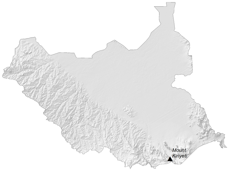
PHYSICAL MAP
South Sudan Elevation Map
South Sudan is a mix of plains, plateaus, and mountains. The central region is mostly flat with vast swampland like the Sudd formed by the White Nile Baḥr al-Jabal section. But the country contains highland areas, especially around its periphery. For example, the Ironstone Plateau straddles its western border with the Central African Republic.
Additionally, the Imatong Mountains lie in the south near the border of Uganda. This mountain chain is the most prominent in the country and contains Mount Kinyeti. It is South Sudan’s highest peak at 3,187 meters (10,456 ft).
Capital City
Juba
Major cities
Aweil
Bentiu
Bor
Kuacjok
Malakal
Rumbek
Wau
Yambio
Yei
Cities, towns and villages
Akobo
Akop
Akot Yirol
Amadi
Boing
Deim Zubeir
Duk Fadiat
Ezo
Fangak
Fathai
Gogrial
Gumbiel
Jonglei
Kajo
Kan
Kodok
Kongor
Leer
Lanya
Lolo
Mvolo
Nasser
Paloich
Pap
Raga
Renk
Tambura
Terakeka
Torit
Towot
Ukwaa
Umm Barbit
Waat
Wakela
War-Awar
Lakes, rivers and water features
Bahr ez Zaraf River
Pibor River
Sobat River
White Nile River
Special Administrative Status
Abyei


The work is really amazing 😍