Monaco Map – Districts and Satellite Image
A Monaco map contains populated places, ports, roads, and imagery – It’s bordered by France, near Italy, and along the Mediterranean Sea.
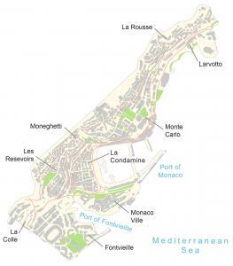
A Monaco map contains populated places, ports, roads, and imagery – It’s bordered by France, near Italy, and along the Mediterranean Sea.
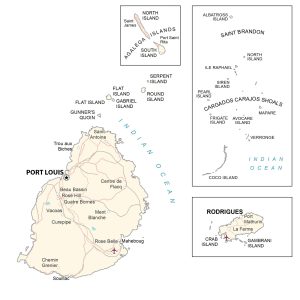
A Mauritius map showing cities, islands, roads, imagery, and elevation – the African island country in the Indian Ocean, east of Madagascar.
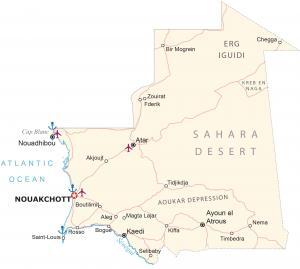
A Mauritania map with cities, towns, water, roads, satellite imagery, and elevation. Mauritania is a country located in northwest Africa.
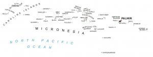
This Micronesia map (Federated States of Micronesia) shows atolls, islands, and water features, an island country in the North Pacific Ocean.
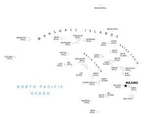
A Marshall Islands map with atolls, islands, and water features – The Marshall Islands are a chain of volcanic islands in the Pacific Ocean.
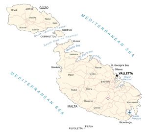
This map of Malta shows cities, towns, channels, islands, imagery, and elevation. Malta is an island country located in the Mediterranean Sea.
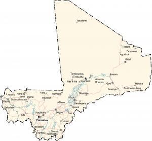
This map of Mali shows cities, towns, lakes, rivers, imagery, and elevation. Mali is a landlocked country located in Western Africa.
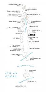
This map of Maldives shows populated places, islands, and water. The Maldives is located in the Indian Ocean southwest of India and Sri Lanka.
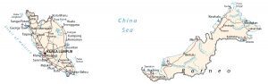
This map of Malaysia contains cities, towns, highways, water, and satellite imagery. Malaysia is a country located in southeastern Asia.
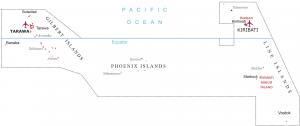
A map of Kiribati displays the islands and populated places – it includes 3 major geographic units of Gilbert, Line, and the Phoenix Islands.