Marshall Islands Map – Atolls and Islands
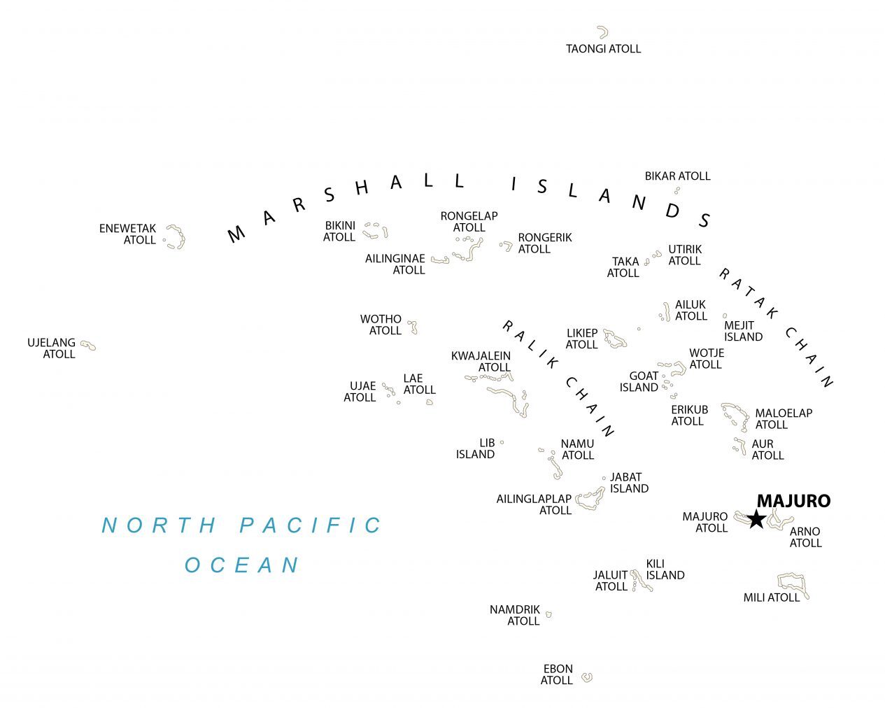
This Marshall Islands map shows atolls, islands, and water features. It includes its capital city of Majuro, which forms a legislative district of the Ratak Chain of the Marshall Islands.
You are free to use our Marshall Islands map for educational and commercial uses. Attribution is required. How to attribute?
About the map
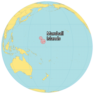
The Marshall Islands are a chain of volcanic islands in the central Pacific Ocean. They are situated to the northeast of Papua New Guinea and Australia and northwest of Kiribati.
The Marshall Islands consist of 5 main islands and 29 atolls occupying an area of 181.43 square kilometers. It has a population of 58,400 people who reside on 5 of its islands. Majuro is the capital and largest city of the Marshall Islands.
The Marshall Islands is one of the newest nations to gain independence since 1986. It’s a popular diving destination such as Bikini Atoll’s World War II ship graveyard site and its underwater marine life.
Capital City
Majuro
Islands and chains
Goat Island
Jabat Island
Kili Island
Lib Island
Mejit Island
Ralik Chain
Ratak Chain
Atolls
Ailinginae Atoll
Ailinglaplap Atoll
Ailuk Atoll
Arno Atoll
Aur Atoll
Bikar Atoll
Bikini Atoll
Ebon Atoll
Enewetak Atoll
Erikub Atoll
Jaluit Atoll
Kwajalein Atoll
Lae Atoll
Likiep Atoll
Majuro Atoll
Maloelap Atoll
Mili Atoll
Namdrik Atoll
Namu Atoll
Rongelap Atoll
Rongerik Atoll
Taka Atoll
Taongi Atoll
Ujae Atoll
Ujelang Atoll
Utirik Atoll
Wotho Atoll
Wotje Atoll
Water features
North Pacific Ocean


