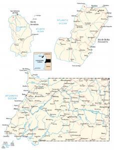
Guinea-Bissau Map – Places and Roads
A Guinea-Bissau map – The African country located on the west coast, which includes the Bissagos Islands, an archipelago of about 88 islands.
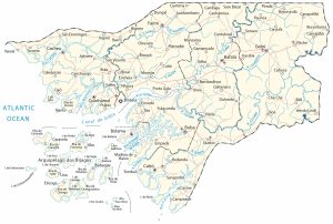
A Guinea-Bissau map – The African country located on the west coast, which includes the Bissagos Islands, an archipelago of about 88 islands.
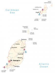
A Grenada map showing islands, populated places, roads, imagery, and elevation. Grenada is an island country located in the Caribbean Sea.
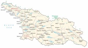
Georgia Europe Map (the country) – Georgia is located at the easternmost part of Europe at the Caucasus Mountains and intersection with Asia.
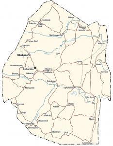
An Eswatini map (or Swaziland map) – Eswatini is a landlocked African country located within South Africa and next to Mozambique.
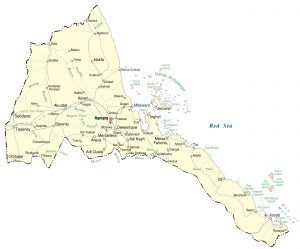
An Eritrea map – Eritrea is located in northeast Africa sharing borders with Ethiopia, Sudan, and Djibouti on the Horn of Africa.
An Equatorial Guinea map – Equatorial Guinea is located in Central Africa along the west coast between Cameroon, Gabon, and the Gulf of Guinea.
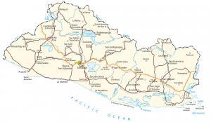
This El Salvador map contains major cities, roads, and imagery – El Salvador is located in Central America bordering Honduras and Guatemala.
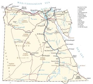
An Egypt map with cities, roads, and imagery – Egypt is a country located in northeastern Africa along the Mediterranean and the Red Sea.
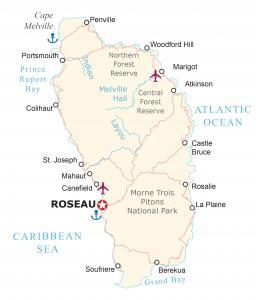
This map of Dominica displays populated places, parishes, and airports – Dominica is a small island located in the Caribbean.
A Djibouti map collection – Djibouti is located in eastern Africa on the Horn of Africa along the Gulf of Aden and Bab al-Mandab Strait.