Djibouti Map
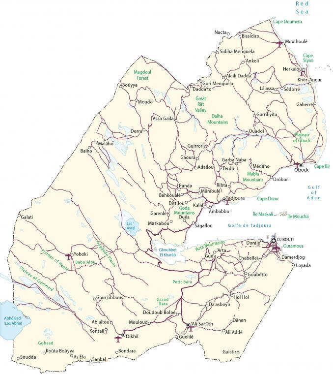
This Djibouti map shows major cities, towns, mountains, and roads of the African country along the Gulf of Aden. Also, satellite imagery and an elevation map highlight the topography of Djibouti.
Djibouti map collection
You are free to use our Djibouti map for educational and commercial uses. Attribution is required. How to attribute?
About the map
Djibouti is located on the Horn of Africa along the Gulf of Aden and Bab al-Mandab Strait. It borders 3 other countries in Eastern Africa including Eritrea to the north, Ethiopia to the west, and Somalia to the southeast.
Djibouti City is the capital and largest city with more than half of its population living there. Djibouti is the third smallest country in Africa occupying an area of 23,200 square kilometers (8,958 sq mi). This makes it larger than Eswatini, but smaller than Rwanda.
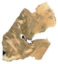
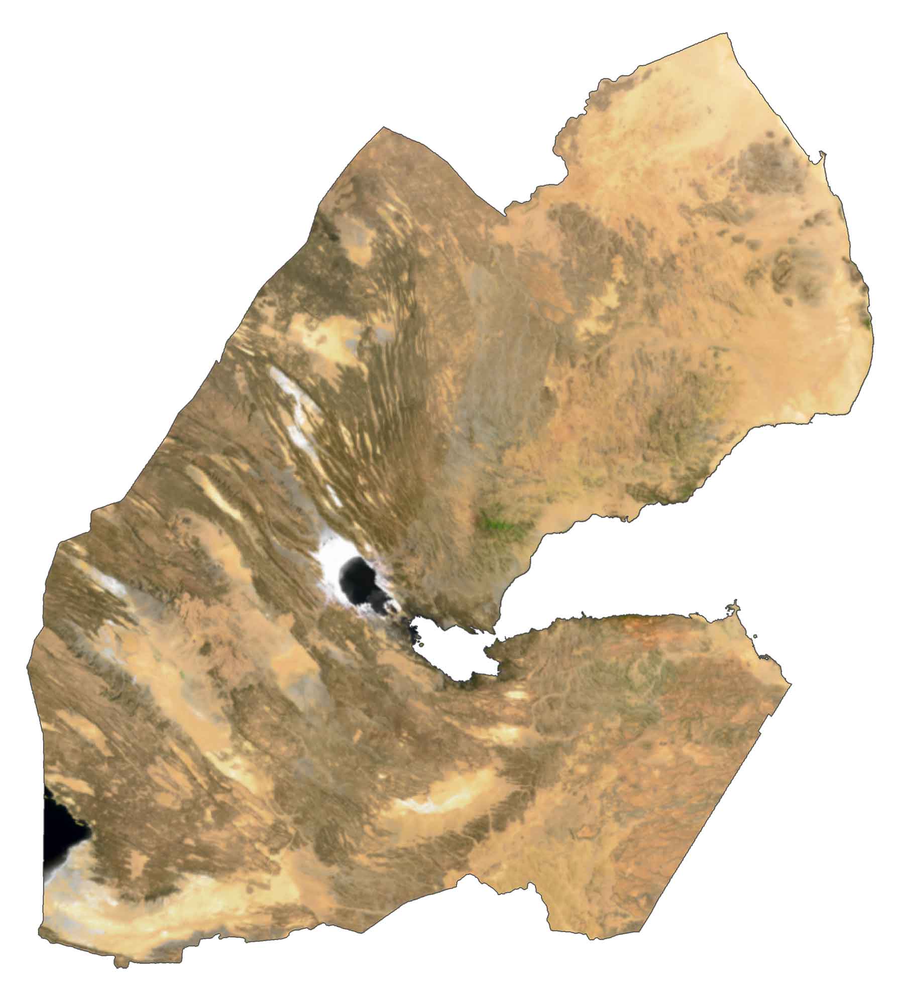
SATELLITE IMAGERY
Djibouti Satellite Map
Djibouti is situated at the northernmost point of the Great Rift Valley. Lake Assal is the largest lake in Djibouti. This crater lake is located in central Djibouti in the Danakil Desert. The country lies between 11° and 14°N latitudes with a hot semi-arid and desert climate.
It’s rich in wildlife such as birds, reptiles, and mammals. Also, it shares 314 kilometers (195 miles) of coastline with the Gulf of Aden and Bab al-Mandab Strait.
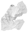
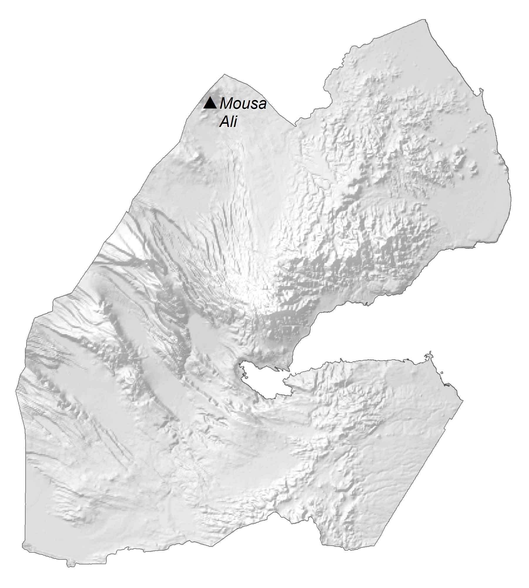
PHYSICAL MAP
Djibouti Elevation Map
The terrain of Djibouti consists mostly of plateaus, plains, and highlands. It boasts 8 mountain ranges. For example, the Manila Mountains lie in the east. Whereas the Goda Mountains are situated northwest of the Gulf of Tadjoura. The highest peak in Djibouti is Mount Moussa. At 6,654 feet (2,028 meters), this stratovolcano sits on the tri-point of Ethiopia, Eritrea, and Djibouti.
Capital City
Djibouti
Major cities and towns
Ali Sabieh
Arta
Dikhil
Obock
Tadjoura
Cities and towns
Ali Addé
Ali Sabieh
Ambouli
Ankoli
Balho
Damerdjog
Gaherré
Galati
Goubetto
Hol Hol
Khor Angar
Moudo
Moulhoulé
Loyada
Randa
Yoboki
Vasama
Lakes, gulfs and capes
Abhé Bad (Lac Abhé)
Lac Assal
Red Sea
Gulf of Aden
Golfe de Tadjoura
Ghoubbet El Kharab
Cape Duan
Cape Bir
Cape Siyan
Cape Doumera
Geographic features
Petit Bara
Grand Bara
Arta Mountains
Great Rift Valley
Plateau of Gammaré
Plateau of Hanlé
Garenle Mountains
Gobaad
Mabla Mountains
Goda Mountains
Plateau of Oblock
Dalha Mountains
Magdoul Forest
Islands
Ile Maskali
Ile Moucha