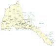
Eritrea Map and Satellite Image
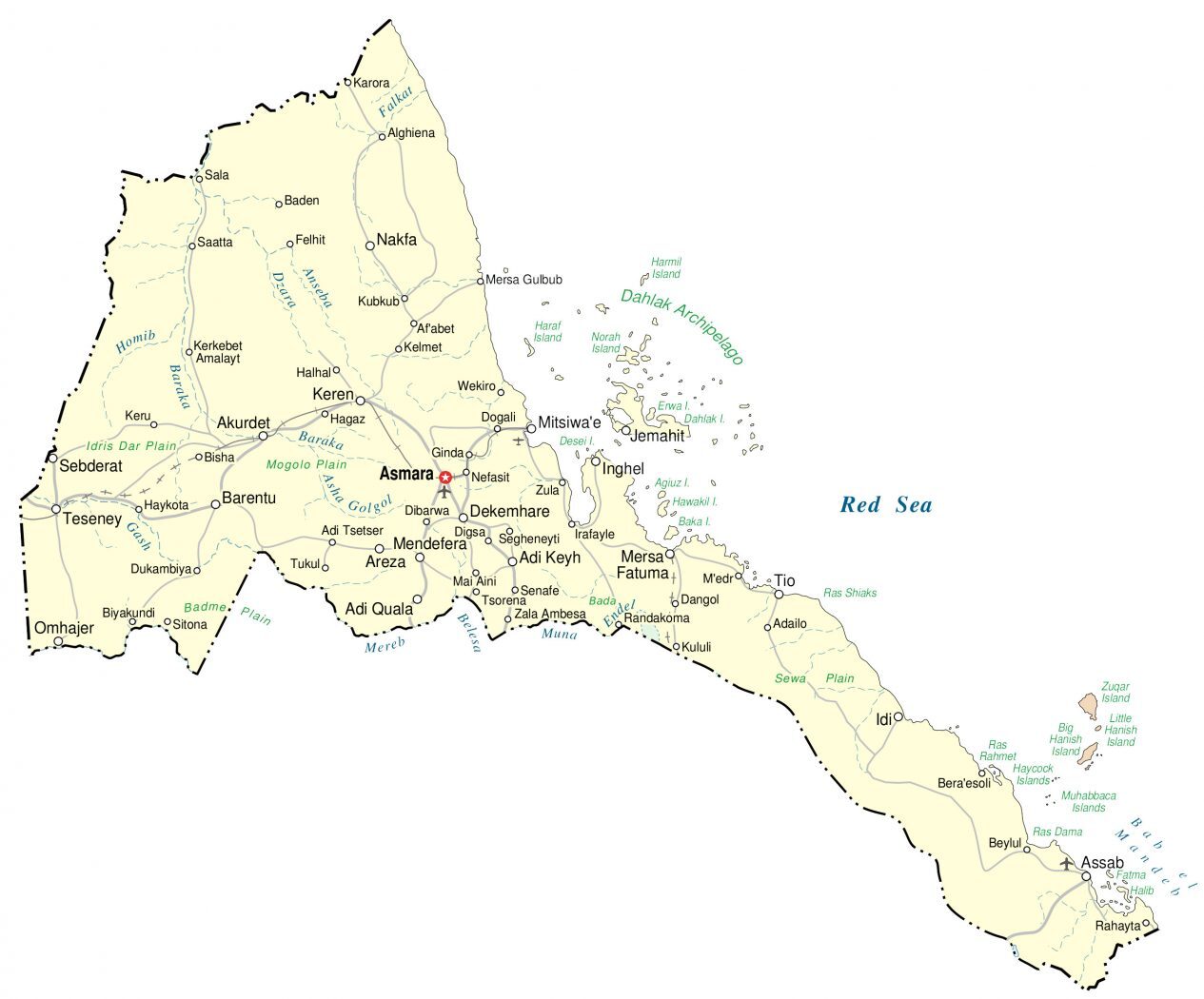
This Eritrea map shows major cities, towns, and highways. A satellite and elevation map displays the lush interior region and its desert landscape in the Danakil Depression.
Eritrea map collection
You are free to use our Eritrea map for educational and commercial uses. Attribution is required. How to attribute?
About the map
Eritrea is located in Northeast Africa and is part of the Horn of Africa. The country is along the Red Sea across from Yemen. It borders 3 other countries including Sudan to the west, Ethiopia to the south, and Djibouti to the southeast.
Also, it consists of the Dahlak Archipelago, which is a group of 124 small islands off the coast of mainland Eritrea in the Red Sea. But only 2 of the islands are inhabited.
It also contains the Hanish Islands and the Southern Red Sea Islands. Asmara is the capital and largest city, known for its Italian influence and architecture.
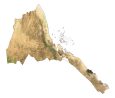
SATELLITE IMAGERY
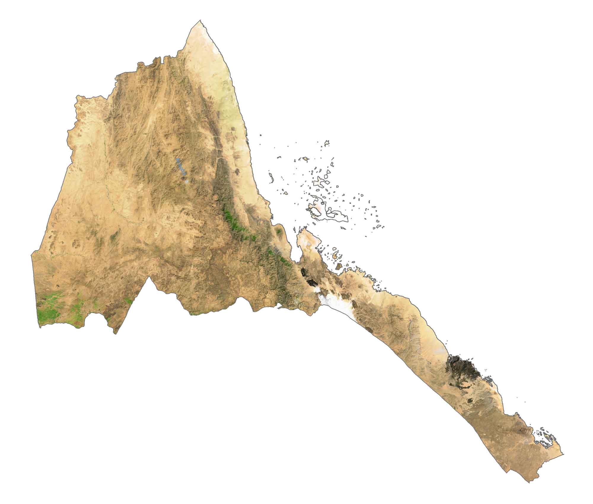
Eritrea Satellite Map
Eritrea is located in Northeast Africa and is part of the Horn of Africa. The country is along the Red Sea across from Yemen. It borders 3 other countries including Sudan to the west, Ethiopia to the south, and Djibouti to the southeast.
Also, it consists of the Dahlak Archipelago, which is a group of 124 small islands off the coast of mainland Eritrea in the Red Sea. But only 2 of the islands are inhabited. It also contains the Hanish Islands and the Southern Red Sea Islands. Asmara is the capital and largest city, known for its Italian influence and architecture.
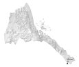
PHYSICAL MAP
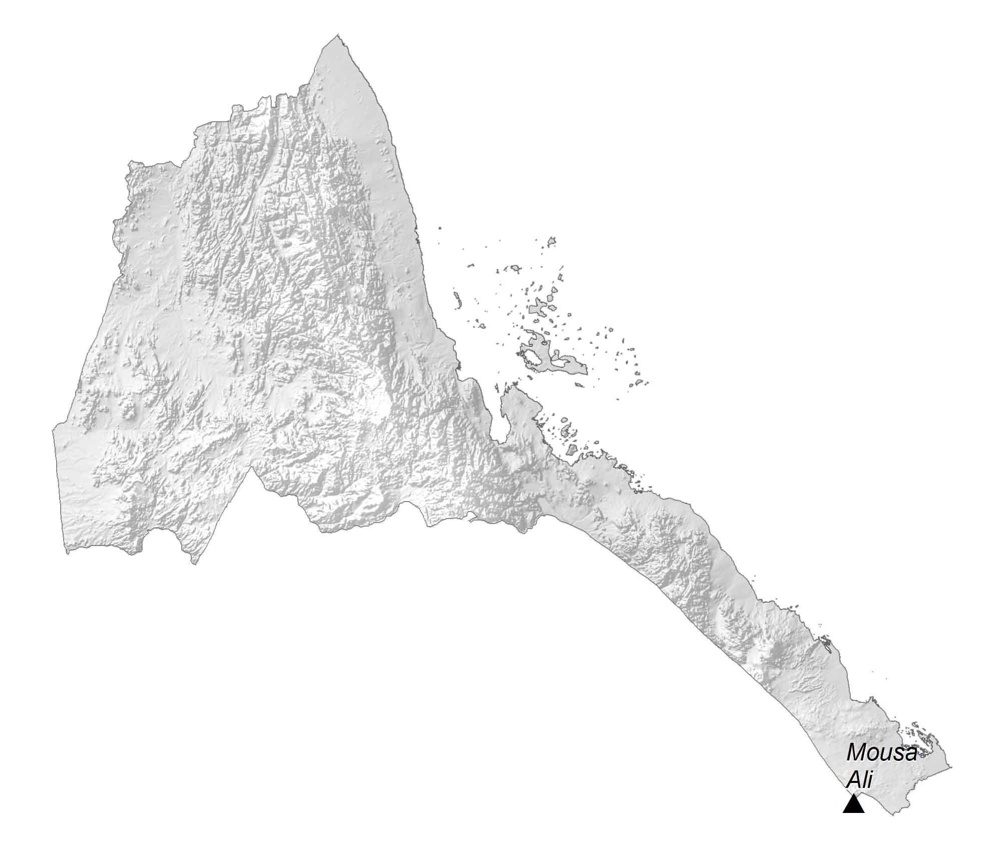
Eritrea Elevation Map
Eritrea is at the intersection point of three tectonic plates diverging and tearing apart. It’s the Danakil Depression that lies at this triple junction. Also, it’s the location of Mount Ayalu, one of two volcanoes as a result of the Afar Triangle.
While the coastal highlands are characterized by their dry and hot region, cliffs and canyons are situated in the south. At 2,021 meters (6,631 ft), Mousa Ali is Eritrea’s highest peak. This stratovolcano is located on the tripoint boundary of Ethiopia, Eritrea, and Djibouti.
Capital City
Asmara
Major cities and towns
Adi Keyh
Adi Quala
Assab
Barentu
Dekemhare
Keren
Massawa
Mendefera
Omhajer
Nakfa
Tio
Cities, towns and villages
Af’abet
Alghiena
Akurdet
Anseba
Areza
Belesa
Beylul
Biyakundi
Dogali
Dukambiya
Ginda
Hagaz
Halhal
Haykota
Inghel
Jemahit
Kerkebet Amalayt
Keru
Kubkub
Mai Aini
Rahayta
Sala
Saatta
Sebderat
Teseney
Tsorena
Wekiro
Zula
Lakes, rivers and creeks
Anseba River
Asha Golgol River
Baraka River
Belsea River
Dzara River
Falkat River
Gash River
Homib River
Mereb River
Red Sea
Islands
Agiuz Island
Dahlak Archipelago
Dahlak Island
Erwa Island
Haraf Island
Harmil Island
Norah Island
Geographic features
Badme Plain
Idris Dar Plain
Mogolo Plain
Sewa Plain