Wyoming Lakes and Rivers Map
A map with major rivers, reservoirs and lakes in Wyoming like Yellowstone Lake, Snake River, Green River, and the North Platte River.
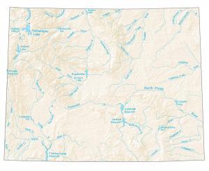
A map with major rivers, reservoirs and lakes in Wyoming like Yellowstone Lake, Snake River, Green River, and the North Platte River.
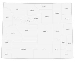
This Wyoming county map displays its 23 counties. Laramie, Natrona and Sweetwater County are the most populated counties in Wyoming.
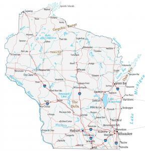
This Wisconsin map contains cities, roads, rivers and lakes. Green Bay, Milwaukee and Madison are major cities shown in this map of Wisconsin.
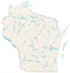
This map displays rivers, reservoirs and lakes of Wisconsin like Wisconsin River. Rivers flow into the Mississippi River and the Great Lakes.
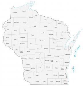
This Wisconsin county map displays 72 its counties. Milwaukee County, Dane County and Waukesha County have the highest population in the state of Wisconsin.
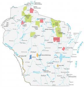
This Wisconsin State Map shows major landmarks and populated places. It includes national forests, wildlife refuges and federal lands in Wisconsin.
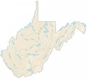
In this map, you will find major rivers, reservoirs, and lakes of West Virginia like Summersville Lake and the Ohio River.
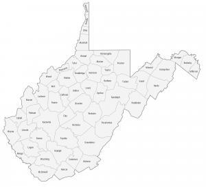
This West Virginia county map displays its 55 counties. Kanawha, Monongalia and Cabell counties are some of the most populated counties in West Virginia.
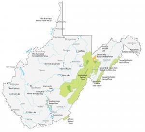
This West Virginia State Map shows major landmarks in West Virginia like national parks, forests, military bases and federal lands in West Virginia.
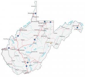
This West Virginia map contains cities, roads, rivers and lakes. Charleston, Morgantown and Parkersburg are the major cities in this map of West Virginia.