South Carolina State Map – Places and Landmarks
This South Carolina State Map shows major landmarks and places in South Carolina like national forests, military bases, wildlife refuges and federal lands.
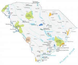
This South Carolina State Map shows major landmarks and places in South Carolina like national forests, military bases, wildlife refuges and federal lands.
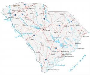
This South Carolina map contains cities, roads, rivers and lakes. Charleston, Columbia and North Charleston are major cities in this map of South Carolina.
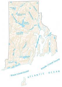
This Rhode Island map shows major rivers, reservoirs, bays, sounds and lakes like Rhode Island Sound. Rivers of Rhode Island flow into the Atlantic Ocean.
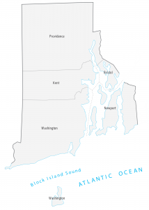
This Rhode Island county map displays its 5 counties. Providence, Bristol, Kent, Newport and Washington are its Rhode Island’s counties.
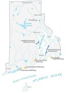
A Rhode Island State Map with landmarks and places in Rhode Island. It includes national wildlife refuges, military bases, and federal lands in Rhode Island
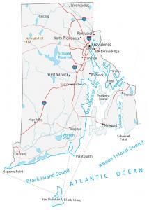
This Rhode Island map displays cities, roads, rivers and lakes. Providence, Pawtucket and Warwick are major cities shown in this map of Rhode Island.
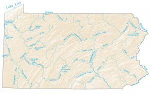
Rivers of Pennsylvania flow toward the Atlantic Ocean, the Mississippi River, or the Great Lakes. This map shows major rivers and lakes.
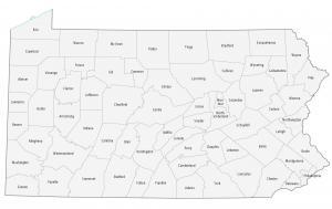
This Pennsylvania county map displays its 67 counties. Philadelphia, Allegheny and Montgomery have the highest population for all counties in Pennsylvania.
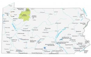
This Pennsylvania State Map shows major landmarks and places in Pennsylvania like national forests, military bases, wildlife refuges and federal lands.
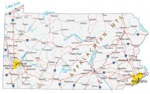
This Pennsylvania map contains cities, roads, rivers and lakes. Philadelphia, Pittsburgh and Allentown are the major cities in this map of Pennsylvania.