Oregon Lakes and Rivers Map
In this map, you will find major rivers, reservoirs and lakes of Oregon like Crater Lake and Goose Lake. Rivers in Oregon flow into the Pacific Ocean.
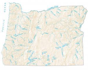
In this map, you will find major rivers, reservoirs and lakes of Oregon like Crater Lake and Goose Lake. Rivers in Oregon flow into the Pacific Ocean.
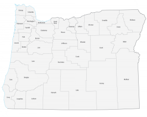
This Oregon county map displays its 36 counties. For example, Multnomah, Washington and Clackamas counties have the highest population in Oregon.
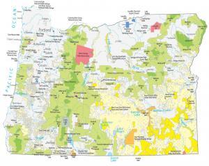
This Oregon State Map shows major landmarks and federal lands in Oregon such as national parks, forests, monuments, wildlife refuges and military bases.
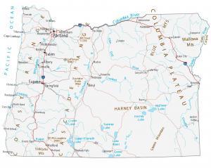
This Oregon map shows cities, roads, rivers and lakes. Portland, Eugene and Salem are some of the major cities shown in this map of Oregon.
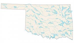
This map shows major rivers, reservoirs and lakes of Oklahoma like Lake Texoma and Eufaula Lake. Rivers generally flow south.
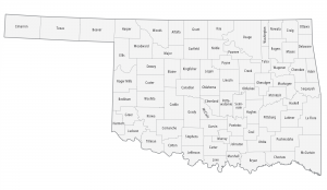
This Oklahoma county map displays its 77 counties. Oklahoma, Tulsa and Cleveland County are some of the most populated counties in Oklahoma.
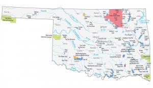
This Oklahoma State Map shows major landmarks and places. It includes national forests, military bases, wildlife refuges and federal lands in Oklahoma.
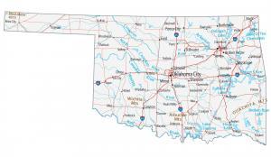
This Oklahoma map contains cities, roads, rivers and lakes. Oklahoma City, Tulsa and Norman are some of the major cities shown in this map of Oklahoma.
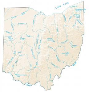
This map shows major rivers, reservoirs and lakes of Ohio. They typically head south to the Ohio River or north to the Great Lakes.
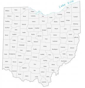
This Ohio county map displays its 88 counties. Franklin, Cuyahoga and Hamilton counties have the highest population in Ohio.