Ohio State Map – Places and Landmarks
This Ohio State Map shows major landmarks and places in Ohio like national parks, forests, military bases, wildlife preserves and federal lands in Ohio.
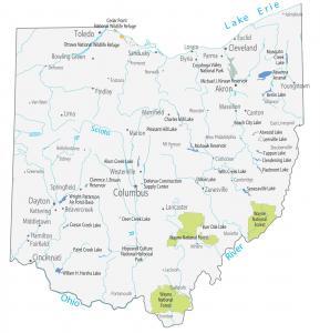
This Ohio State Map shows major landmarks and places in Ohio like national parks, forests, military bases, wildlife preserves and federal lands in Ohio.
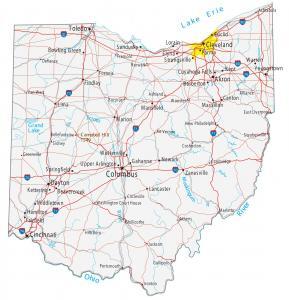
This Ohio map contains cities, towns, roads, rivers and lakes. Columbus, Cleveland and Cincinnati are major cities shown in this map of Ohio.
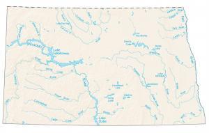
This map shows rivers, reservoirs and lakes of North Dakota like Lake Sakakawea, Missouri River in the west, and Red River in the east.
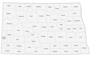
This North Dakota county map displays its 53 counties. Cass, Burleigh and Grand Forks county have the highest population of all counties in North Dakota.
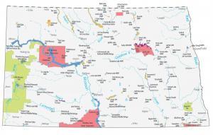
This North Dakota State Map shows major landmarks in North Dakota. It includes national parks, military bases, wildlife preserves and historic sites.
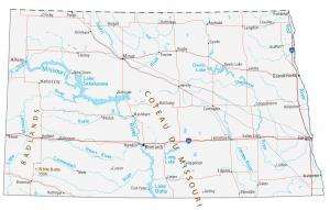
This North Dakota map contains cities, roads, rivers and lakes. Fargo, Bismarck and Grand Forks are some of the major cities in this map of North Dakota.
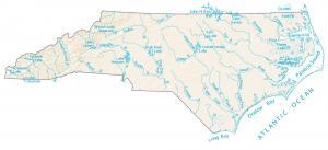
This map shows major rivers, reservoirs, bays, sounds and lakes of North Carolina. Rivers of North Carolina flow into the Atlantic Ocean.
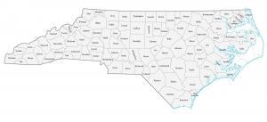
This North Carolina county map displays its 100 counties. Mecklenburg, Wake and Guilford counties have the highest population in North Carolina.
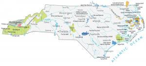
This North Carolina State Map shows major landmarks and populated places. It includes national parks, forests, military bases and wildlife in North Carolina.
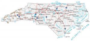
This North Carolina map contains cities, roads, rivers and lakes. Charlotte, Raleigh and Greensboro are major cities in this map of North Carolina.