New York Lakes and Rivers Map
This map shows major rivers, reservoirs and lakes of New York. Rivers in New York flow into the Atlantic Ocean and the Great Lakes.
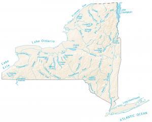
This map shows major rivers, reservoirs and lakes of New York. Rivers in New York flow into the Atlantic Ocean and the Great Lakes.
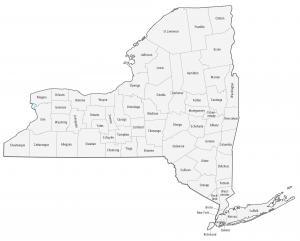
This New York county map displays its 62 counties. Kings, Queens and New York county are some of the largest counties in New York in terms of population.
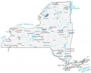
This New York State Map shows major landmarks and places in New York such as parks, forests, military bases, research, wildlife refuges and federal lands.
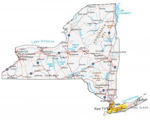
This New York map displays cities, roads, rivers and lakes. New York City, Buffalo and Rochester are major cities in this map of New York.
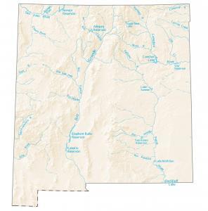
This map shows rivers, reservoirs, and lakes of New Mexico like the Rio Grande and Pecos River. The Rio Grande Basin spans the largest area.
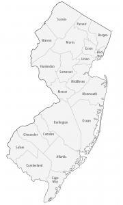
This New Jersey county map displays its 21 counties. Bergen, Monmouth and Hunterdon have the highest population in New Jersey.
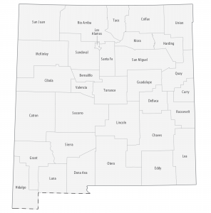
This New Mexico county map displays its 33 counties. Bernalillo, Dona Ana and Santa Fe are the most populated counties in New Mexico.
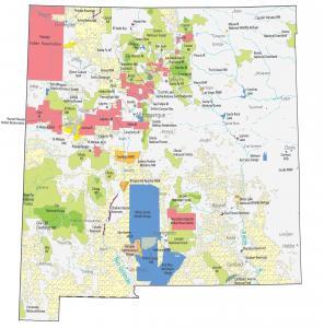
This New Mexico State Map shows major landmarks in New Mexico such as national parks, forests, military bases, preserves and other federal lands.
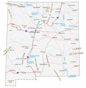
This New Mexico map contains cities, roads, rivers and lakes. Albuquerque, Las Cruces and Rio Rancho are major cities shown in this map of New Mexico.
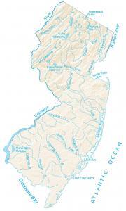
This map shows major rivers, reservoirs and lakes of New Jersey like Lake Hopatcong. Rivers and streams of New Jersey flow into the Atlantic Ocean.