Nebraska Lakes and Rivers Map
This map displays major rivers, reservoirs, and lakes of Nebraska including Platte River, Lake McConaughy and Merritt Reservoir.
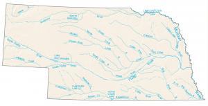
This map displays major rivers, reservoirs, and lakes of Nebraska including Platte River, Lake McConaughy and Merritt Reservoir.
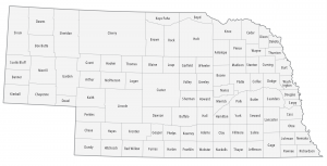
This Nebraska county map displays its 93 counties. Douglas, Lancaster and Sarpy are some of the largest counties in Nebraska in terms of population.
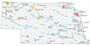
This Nebraska State Map shows major landmarks such as national forests, military bases, preserves, wildlife refuges and other federal lands in Nebraska.
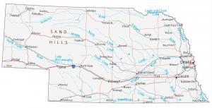
This Nebraska map contains cities, roads, rivers and lakes. Omaha, Lincoln and Bellevue are some of the major cities shown in this map of Nebraska.
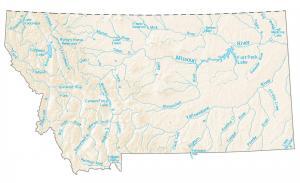
On this map, you will find major rivers, reservoirs, and lakes of Montana like Fort Peck Lake, Flathead Lake, and the Missouri River.
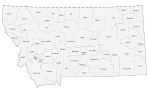
This Montana county map displays its 56 counties. Yellowstone, Missoula and Gallatin are some of the most populated counties in Montana.
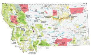
This Montana State Map shows major landmarks and places in Montana. It includes national forests, military bases, wildlife refuges and federal lands.
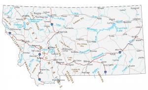
This Montana map displays its cities, roads, rivers and lakes. Billings, Missoula and Great Falls are some of the major cities shown in this map of Montana.
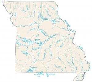
This map contains major rivers, reservoirs and lakes in the state of Missouri. The biggest rivers here are the Mississippi and Missouri River.
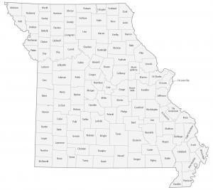
This Missouri county map displays its 114 counties. St Louis, Jackson and St Charles county have the highest population out of all counties in Missouri.