Maryland State Map – Places and Landmarks
This Maryland State Map shows major landmarks and places in Maryland. It includes national parks, military bases, research facilities and wildlife refuges.
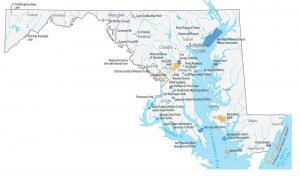
This Maryland State Map shows major landmarks and places in Maryland. It includes national parks, military bases, research facilities and wildlife refuges.
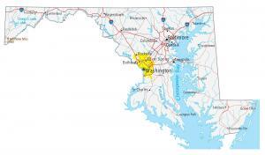
This map of Maryland contains cities, roads, rivers and lakes. Baltimore, Columbia and Annapolis major cities shown in this map of Maryland.
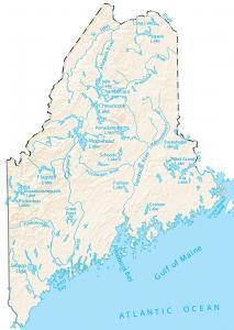
In this map, you will find major rivers, reservoirs and lakes of Maine like Moosehead and Chamberlain Lake. Rivers in Maine flow into the Atlantic Ocean.
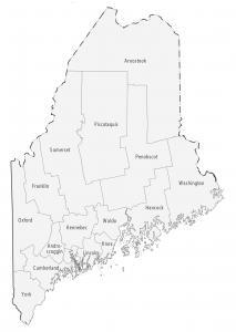
This Maine county map displays its 16 counties. Cumberland, York and Penobscot are some of the largest counties in Maine in terms of population.
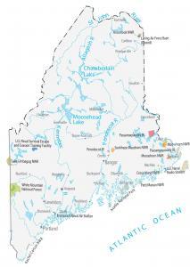
This Maine State Map shows major landmarks and places in Maine. It includes national forests, parks, preserves, military bases and federal lands in Maine.
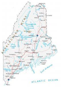
This Maine map displays cities, interstate highways, rivers and lakes. Portland, Lewiston and Bangor are major cities shown in this map of Maine.
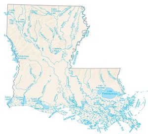
This map contains major rivers, bayous and lakes of Louisiana. It includes Lake Pontchartrain, Caddo Lake and Bayou D’Arbonne Lake.
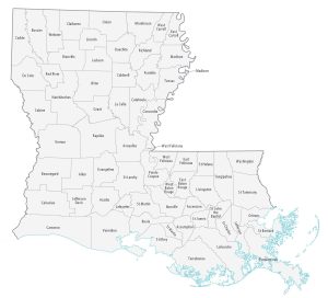
This Louisiana parish map displays its 64 parishes. East Baton Rouge, Jefferson and Orleans are some of the most populated counties in Louisiana.
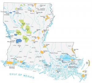
This Louisiana State Map shows major landmarks, places, wildlife, military lands in Louisiana. It includes national forests like Kisatchie National Forest.
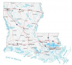
This Louisiana map displays cities, roads, rivers and lakes. New Orleans, Baton Rouge and Shreveport are major cities shown in this map of Louisiana.