Map of Palau – Cities and Islands
A map of Palau (imagery, roads, elevation) – Palau is an island country part of Micronesia with about 340 islands in the Pacific Ocean.
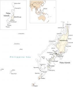
A map of Palau (imagery, roads, elevation) – Palau is an island country part of Micronesia with about 340 islands in the Pacific Ocean.
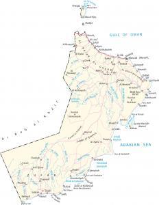
A map of Oman that displays cities, roads, satellite imagery, and elevation – the oldest independent state in the Arab world.
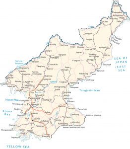
A map of North Korea with cities, roads, satellite imagery, and elevation – a country in Eastern Asia along the East Sea (Sea of Japan).
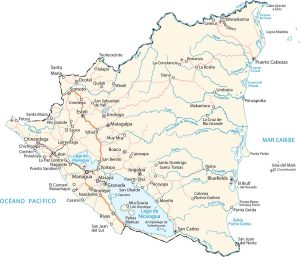
A map of Nicaragua showing cities, roads, imagery, and elevation – a Central American country between the Pacific Ocean and Caribbean Sea.
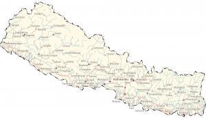
A Nepal map with cities, roads, satellite imagery, and elevation. Nepal is a country mostly in the Himalayas and North Indian River Plain.
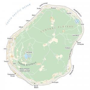
This map of Nauru (Pleasant Island) displays villages, roads, satellite imagery, and regions – the smallest island country in the world.
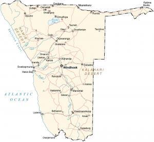
A map of Namibia with cities, roads, satellite imagery, and elevation – located in southeastern Africa along the South Atlantic Ocean.
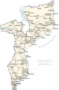
A map of Mozambique displays cities, roads, imagery, and elevation. Mozambique is located in southern Africa along the Indian Ocean.
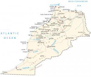
A Morocco map with cities, roads, imagery, and elevation – in northwestern Africa along the Mediterranean Sea and North Pacific Ocean.
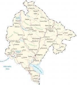
A Montenegro map with cities, roads, imagery, and elevation. Montenegro is a southeastern European country located along the Adriatic Sea.