Map of Mauritius – Islands and Roads
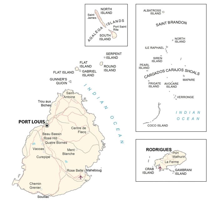
This map of Mauritius displays cities, towns, and roads for the island in the southeast of Africa. Satellite imagery and a terrain map reveal the topography of the islands of Mauritius and Rodrigues.
You are free to use our Mauritius map for educational and commercial uses. Attribution is required. How to attribute?
About the map
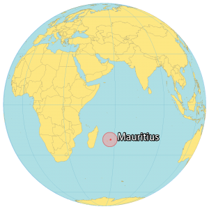
Mauritius is an African island country in the Indian Ocean. It’s situated 2,000 kilometers (1,200 mi) from the southeast coast of Madagascar on the mainland African continent.
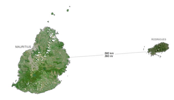
It includes the main island of Mauritius, as well as Rodrigues to the east, the Agalega Islands to the north, and St. Brandon to the northeast. The total population is about 1.265 million people. Port Louis is the capital and largest city of Mauritius.
SATELLITE IMAGERY
Mauritius Satellite Map
Mauritius is known for its beaches, reefs, and mountainous interior. Its small coastal plain rises to eventually a central plateau. The islands are volcanic in origin, with the main island consisting of discontinuous mountain ranges.
This includes its highest peak, Piton de la Petite Rivière Noire, part of the Black River mountain range to the southwest of the Island of Mauritius. At 828 m (2717 ft), this is the highest peak of Mauritius.
Capital City
Port Louis
Island chains
Agalega Islands
Cargados Carajos Shoals
Rodrigues
Saint Brandon
Islands
Albatross Island
Avocare Island
Coco Island
Crab Island
Flat Island
Frigate Island
Gabriel Island
Gambrani Island
Gunner’s Quoin
Ile Raphael
Mapare Island
North Island
North Island
Pearl Island
Round Island
Serpent Island
Siren Island
South Island
Verronge Island
Populated places
Beau Bassin
Centre de Flacq
Chemin Grenier
Curepipe
La Ferme
Maheboug
Ment Blanche
Port Mathurin
Port Saint Rita
Quatre Bornes
Rose Belle
Rose Hill
Saint-Antoine
Saint James
Souillac
Trou aux Biches
Vacoas