Map of Calgary, Canada
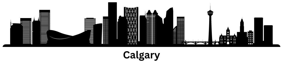
Map of Calgary, Alberta
I suppose you’re here for a map of Calgary, aren’t you? Well, you’re in luck because we’ve built several detailed maps to get acquainted with the fourth-largest city in Canada.
First, we have an interactive map provided by Google. Next, we’ve designed a road map showing major highways and streets. Finally, we display a neighborhood map and a list of things to do.
So if you’re looking to visit the city at the center of Canada’s oil industry, make sure to print this one out before you go.
Jump To: Interactive Map | Printable Road Map | 10 Things to Do | Reference Map
Calgary map collection
Interactive Map of Calgary
Get up-to-date with the Stampede City using an interactive map. This is the most updated map in the world, which includes everything from restaurants to shopping. While you’re at it, zoom out a bit and you’ll see that the mountains are just an hour away from the city.
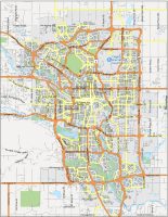
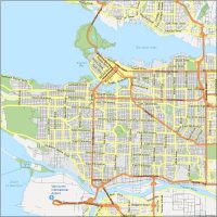
Calgary Road Map
This free road map of Calgary can help you get anywhere in the city. It includes major highways and street names so you can navigate around the city. Print it for free and leave it in your glove compartment in case you ever get lost.
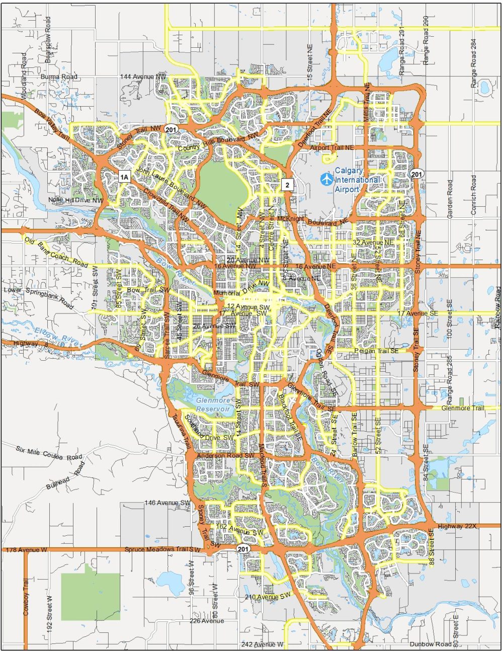
Highways: 1A, 2, 8, 22, 201, Queen Elizabeth II Highway, Trans-Canada Highway
Major Roads: 16 Avenue, 178 Avenue, 36 Street, 96 Avenue, Airport Trail, Anderson Road, Beddington Trail, Bow Bottom Trail, Bowness Road, Country Hills Boulevard, Crowchild Trail, Deerfoot Trail, Glenmore Trail, John Laurie Boulevard, Macleod Trail, McKnight Boulevard, Métis Trail NE, Sarcee Trail, Shaganappi Trail, Spruce Meadows Trail, Stoney Trail, Township Road 225, Tsuut’ina Trail
Roads: 14 Street, 52 Street, 162 Avenue, Barlow Trail, Fairmount Drive, Memorial Drive, Stephen Avenue
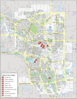
10 Things To Do in Calgary
Use this attraction map to find the best things to do in Calgary. You’ll notice the top sights are in downtown Calgary close to Bow River. This includes attractions like Calgary Tower, the Stampede, and Studio Bell. But there are also other attractions outside the core such as Heritage Park, Gasoline Alley Museum, and Fish Creek Provincial Park.
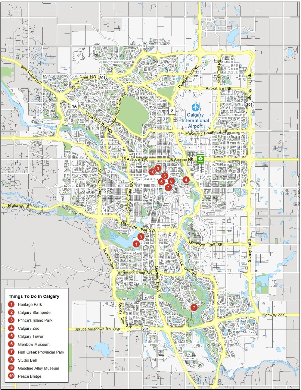
Calgary is located in the Province of Alberta and is the most populous city in that province. When you’re visiting the city, check out any of the attractions on this list of things to do.
- Heritage Park
- Calgary Stampede
- Prince’s Island Park
- Calgary Zoo
- Calgary Tower
- Glenbow Museum
- Fish Creek Provincial Park
- Studio Bell
- Gasoline Alley Museum
- Peace Bridge
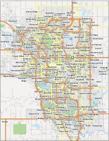
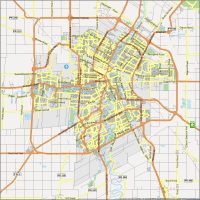
Calgary Reference Map
Last but not least, we’ve created this neighborhood map for you to print and explore. Use this reference map of Calgary to learn about the different areas of the city. You can also find some of the key communities on the outskirts of the city. And don’t forget to check out our Edmonton map, if you’re looking for a road trip.

Airports: Calgary International Airport (YYC)
Water Features: Glenmore Reservoir, Bow River
Suburbs: Sage Hill, Simons Valley, Evanston, Coventry Hills, Country Hills Village, Skyview Ranch, Saddle Ridge, Taradale, Falconridge, Royal Vista, Rocky Ridge, Huntington Hills, Brentwood, Varsity, Aspen Woods, Rosscarrock, Signal Hills, Springbank Hill, Sunridge, Marlborough, Inglewood, Haysboro, Alyth, Lake Bonavista, Auburn Bay, Mahogany, Seton, Somerset, Shawnessy
the best there is. the best there was. and the best there ever will be.
thanks!