Map of Hamilton, Ontario
If you’re planning your first visit to Hamilton, Ontario, this map collection can help you learn everything you need to know.
We’ve designed 3 maps so you can explore Hamilton. It includes a road map, a list of things to do, and a neighborhood map.
Whether you’re trying to plan a visit or make a road trip, make sure to print our maps of Hamilton before you go.
Jump To: Interactive Map | Printable Road Map | 10 Things to Do | Reference Map
Hamilton map collection
Interactive Map of Hamilton
Before you check out our printable maps, we’ve included an interactive map. Because the key is to know what activities you can do, this map will give you the latest information. But the best part is that there are no bounds to how far you can explore.
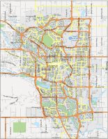
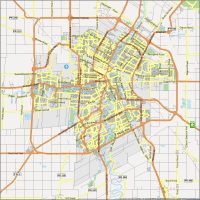
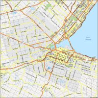
Hamilton Road Map
Hamilton is an exceptional city for exploring. It’s small enough that you can get from one end of it to the other in an hour or so. But it has so much to offer. In fact, it’s the third largest city in Ontario after Toronto and Ottawa. This free road map can show you the way to anywhere you want to go in the city.

Highways: 5, 6, 8, 52, 403
Parkways: Alexander Graham Bell Parkway, Lincoln M. Alexander Parkway, Red Hill Valley Parkway
Major Roads: Brock Road, Claremont Access, Cootes Drive, Dundas Street, Dundurn Street, King Street, Main Street, Nikola Tesla Boulevard, Paradise Road, Queen Elizabeth Way, Queenston Road, Upper James Street, Victoria Avenue, Wellington Street, York Boulevard
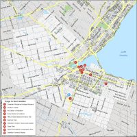
10 Things To Do in Hamilton
If there were only 10 things we could recommend you to do in Hamilton, this would be it. Much of it is confined to the core downtown area. But other conservation sites like the Devil’s Punchbowl, Gage Park, and its botanical gardens are just outside.
Hamilton is a major city in the Province of Ontario and is home to the CFL’s Tiger-Cats. These are our recommended attractions that you should check out in Hamilton.
- Canadian Warplane Heritage Museum
- Dundurn Castle
- Art Gallery of Hamilton
- Royal Botanical Gardens
- HMCS Haida National Historic Site
- Bayfront Park
- Whitehern Historic House and Garden
- Gage Park
- Devil’s Punchbowl Conservation Area
- Hamilton Farmers’ Market
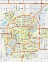
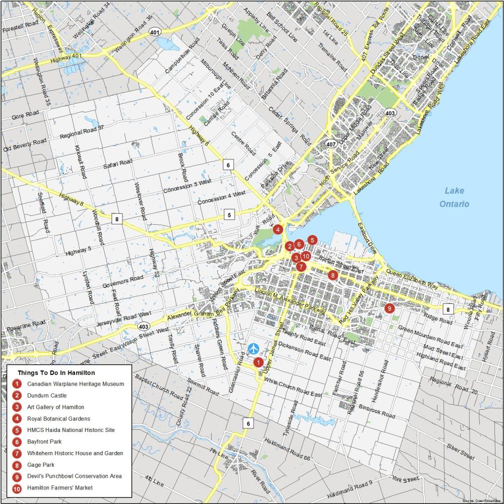
Hamilton Reference Map
Hamilton is filled with all sorts of cozy neighborhoods for you to experience. With this map as your ally on your travels, you can see it all at a glance. That includes everything just outside the city boundary.
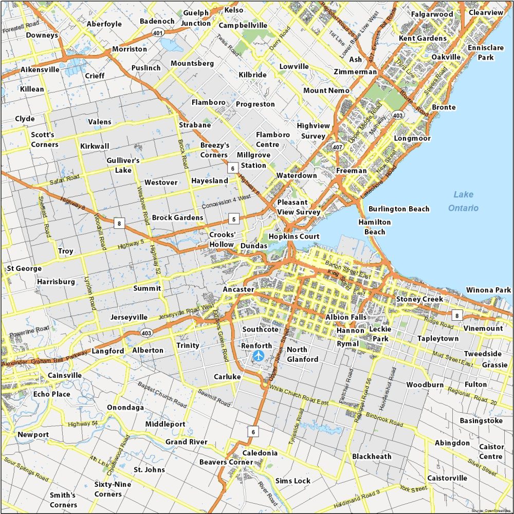
Airports: John C. Munro Hamilton International Airport
Conservation Areas: Beverly Swamp Conservation Area, Dundas Valley Conservation Area, Devil’s Punch Bowl, Governor’s Road Conservation Area, Mountsberg Conservation Area, Valens Dam and Reservoir Conservation Area
Communities: Alberton, Albion Falls, Ancaster, Brock Gardens, Carluke, Copetown, Crooks’ Hollow, Dundas, Elfrida, Flamboro, Glanford Station, Gulliver’s Lake, Hamilton Beach, Hannon, Hayesland, Jerseyville, Kirkwall, Leckie Park, Millgrove Station, Mountsberg, North Glanford, Progreston, Renforth, Rockton Airfield, Rymal, Southcote, Stoney Creek, Strabane, Summit, Tapleytown, Trinity, Troy, Tweedside, Valens, Vinemount, Waterdown, Westover, Winona Park, Woodburn